
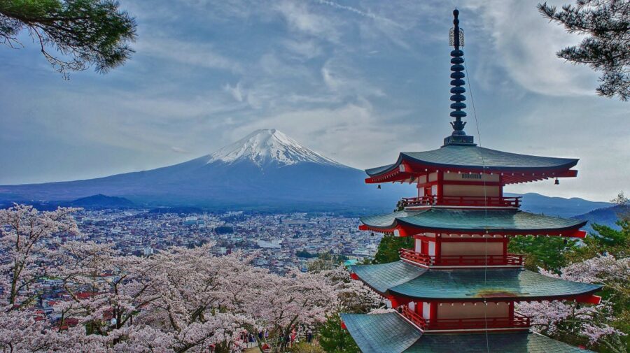

In February 2026 the city of Fujiyoshida canceled its own cherry blossom festival. The festival sits under the Chureito Pagoda, the five-story pagoda with Mount Fuji behind it that has stood in for “Japan” on a thousand posters, and the city said its residents could no longer live with the crowds it drew. The view is still there. The festival is not.
A beautiful place is half a plan. The other half is the month, the hour and the train, and for a few of these, whether you can get in at all. Here are twenty-five, region by region from Hokkaido to Okinawa. Some are famous for good reason, some are a train, a bus and a long walk from anywhere, and a few are best on one evening a month.
Several are spoiled at their peak by crowds, and for those the shoulder month is the better bet. Fares and dates are as of November 2026.
Contents9 sections
Hokkaido
Japan’s northern island is big, and the two places here sit about five hours apart by car. Pick one per trip unless you have a week.
Shirogane Blue Pond, Biei
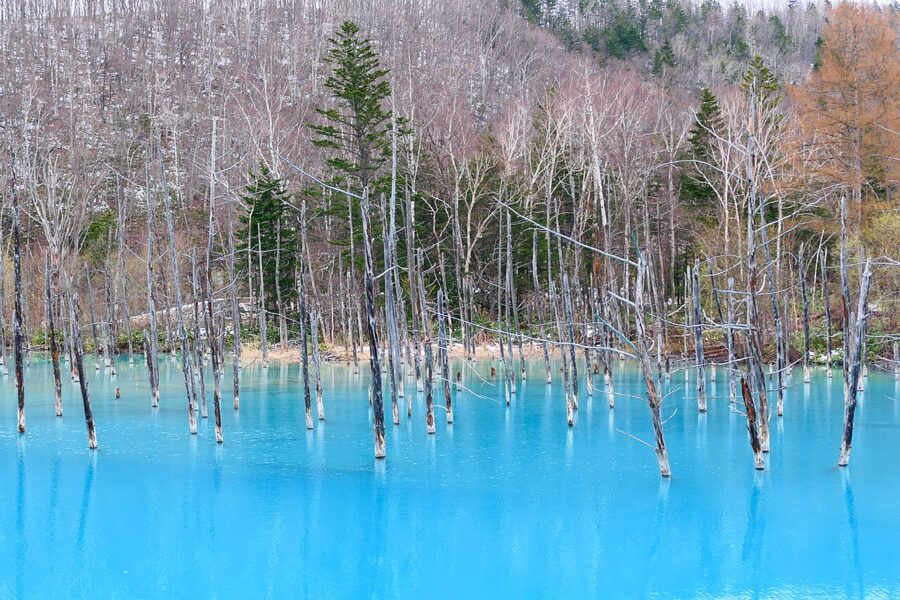

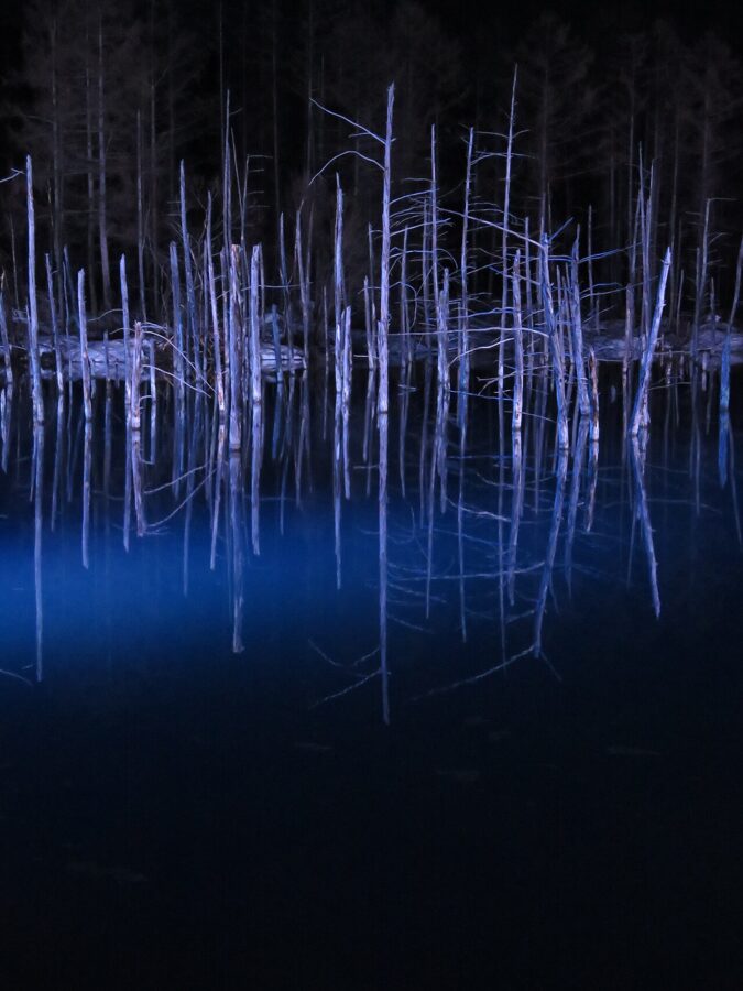
The Blue Pond (白金青い池, Shirogane Aoiike) is an accident. After Mount Tokachi erupted in 1988, a concrete dam was built across the Biei River to hold back mudflows, and the water that pooled behind it turned a milky blue from the minerals in the springs upstream. The dead larches standing in it are the trees that were there before the water came.
Come between May and October to see the blue, ideally before 9 a.m. when the tour buses are still on the road. In winter the pond freezes and snow covers it, so the draw becomes the evening light-up: this season it runs from October 22, 2026 to April 21, 2027, free, until 9 p.m. Buses from JR Biei Station take about 20 minutes.

Shiretoko Five Lakes
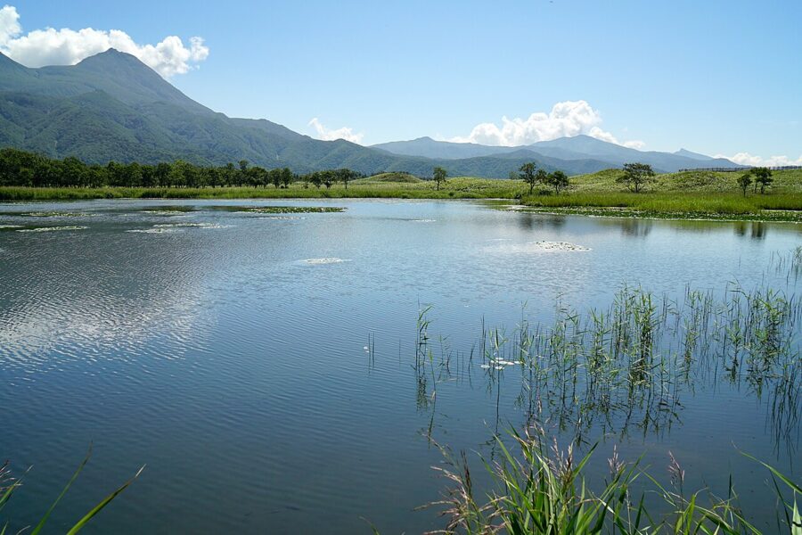
Shiretoko, the peninsula at Hokkaido’s northeast tip, is a World Natural Heritage site and brown bear country, and the Five Lakes (知床五湖, Shiretoko Goko) are the easiest way into it. A raised boardwalk about 800 meters long runs out to the first lake, free and open to anyone, with an electric fence underneath to keep bears off it.
The ground trails around all five lakes are a different matter. From May 10 to July 31, when bears are most active, you can only walk them on a guided tour; for the rest of the season you take a short lecture first and pay a fee. The site opens in late April and closes in early November. Go in late September or October, when the forest turns and the bear rules relax.

Tohoku: two winters and one autumn river
The northeast of Honshu is where Japan does snow properly. Two of these are winter places, and they sit on the same Shinkansen line.
The snow monsters of Zao
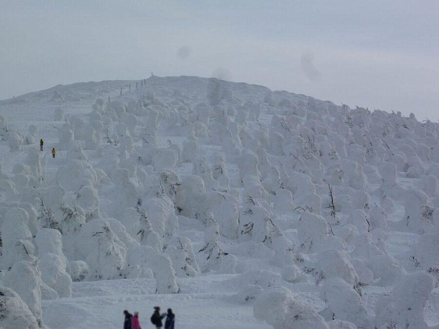
In midwinter the firs on the upper slopes of Mount Zao, on the Yamagata side, are coated in rime ice until they look like a crowd of hunched white figures. Locals call them juhyō (樹氷), ice trees; English-speaking skiers call them snow monsters. They need hard cold and constant wind off the Sea of Japan, and they are fullest from late January into February.
The Zao Ropeway lifts you from Zao Onsen to Jizo Sancho Station at 1,661 meters, where you stand among them. This winter the evening light-up is listed for Fridays, weekends and holidays from December 26, 2026 to February 23, 2027, 5 to 9 p.m., weather permitting. Buses from JR Yamagata Station to Zao Onsen take about 40 minutes. Eat imoni, Yamagata’s taro and beef stew, back in town.

Ginzan Onsen
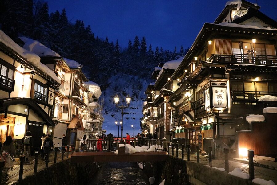
Ginzan Onsen is a single lane of three- and four-story wooden inns along a narrow river, most of them rebuilt in the Taisho era a century ago, lit by gas lamps after dark. Under snow I would call it the most beautiful village in Japan. It is also small enough that the evening crowds began to fill it beyond anything its residents could manage, and in the past few winters the town has had to ration access.
For the 2026–27 season, from December 19 to March 7, day visitors cannot drive or walk in. You park at the Taisho Roman-kan rest stop and ride a shuttle, with round-trip fares of ¥700 to ¥1,500 (about $5 to $10) depending on the hour, plus a ¥165 (about $1) booking fee, and the late-afternoon slots cost most.
Book online by 5 p.m. the day before; the town warns of waits of up to three hours for same-day seats. Better still, stay the night: once the day crowd leaves, the lamps are yours.

Oirase Stream
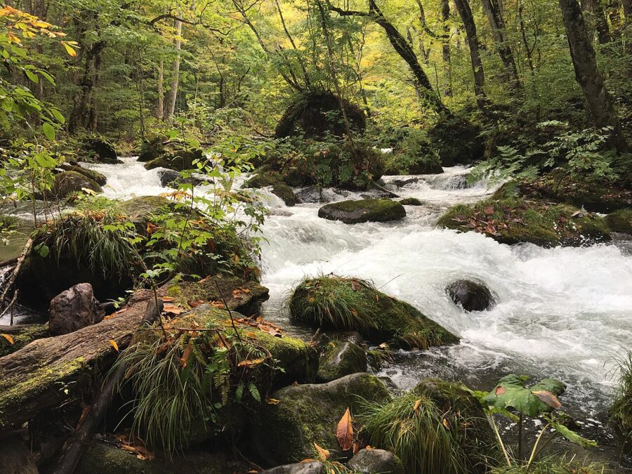
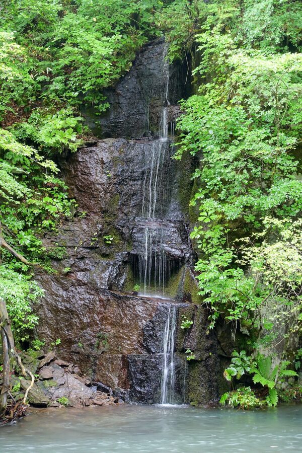
The Oirase is a mountain stream running 14 kilometers from Yakeyama down to Nenokuchi on the shore of Lake Towada, and a path follows it the whole way, past waterfalls and mossy boulders under beech and maple. Walking all of it takes about five hours. Most people walk one section between bus stops, an hour or two.
Autumn color usually peaks in the last week of October and the first days of November, and that is when the road beside the stream jams. In 2026 Aomori Prefecture closed it to private cars for a week in September instead; check whether autumn closures return. JR buses run from Aomori and Hachinohe stations. Order the grilled himemasu, the small landlocked salmon of Lake Towada, at the lake end.

Within a day of Tokyo
Chureito Pagoda and Lake Kawaguchi
The pagoda is a war memorial completed in 1963, set on the slope of Arakurayama above Fujiyoshida, and the famous view is from a deck reached by 398 steps behind Arakura Fuji Sengen Shrine. From Shinjuku it is about two hours by train to Shimoyoshida Station on the Fujikyu line, then a 10- to 20-minute walk.
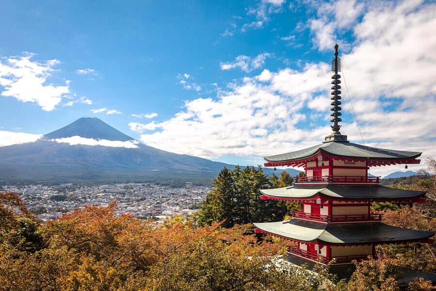

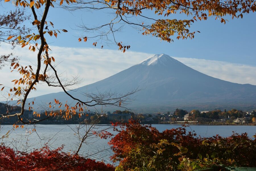
Cherry season, roughly the first half of April, is the time to avoid. Even without a festival, the city ran traffic controls from April 1 to 19 in 2026, and the steps queue. Come in late October or November, when the maples around the pagoda turn and Fuji has fresh snow, and arrive at sunrise. Then take the bus over to Lake Kawaguchi for the north-shore view and a bowl of Yoshida udon, the hard, chewy local noodle.
Hitachi Seaside Park
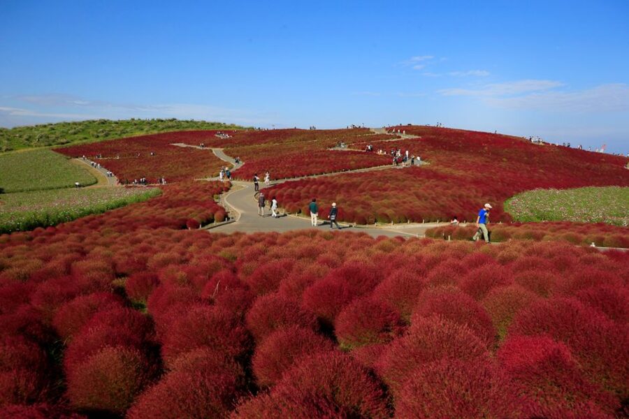
For about two weeks in late April, Miharashi Hill in Hitachinaka is covered in millions of nemophila, a small sky-blue flower, until the hill and the sky meet without a line. In 2026 it peaked on April 16. In October the same hill turns red with round kochia bushes.
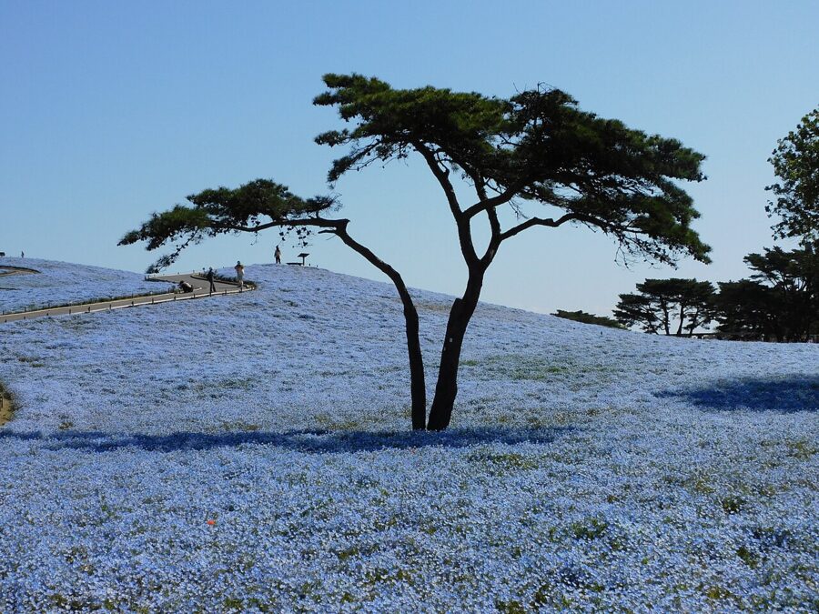

Admission is ¥450 (about $3) for adults, with a seasonal surcharge added in April, May and October. Outside its peak weeks, the park closes on Tuesdays.
From Ueno, the limited express to Katsuta takes about 80 minutes, and buses from Katsuta’s east exit take about 15. Go on a weekday, early. Buy a bag of hoshiimo, the dried sweet potato Hitachinaka is famous for, on the way home.
The Kamakura Alps
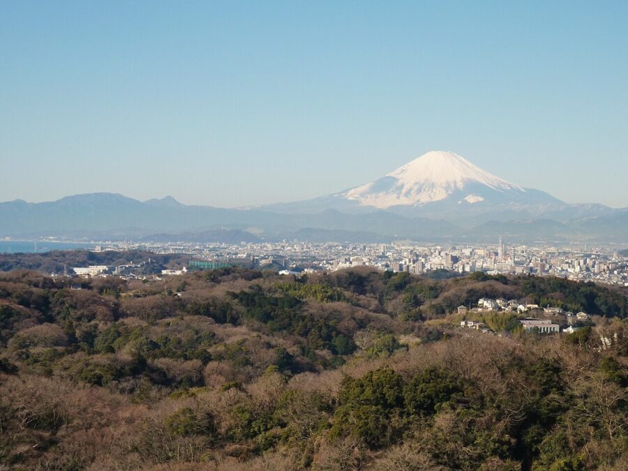
The Kamakura Alps are a ridge of low wooded hills above the old shogun’s capital, with a two-and-a-half-hour path that starts behind Kenchoji temple and ends at Zuisenji. Nothing on it is higher than 159 meters. But on a cold, clear morning between late autumn and early spring, the deck at Shojoken shows you Kenchoji’s roofs, Sagami Bay and Mount Fuji in one look.
Kamakura’s streets are packed at weekends and in June hydrangea season, and the ridge is where the crowd thins. Kenchoji charges ¥500 (about $3), cash only. Kita-Kamakura Station is under an hour from Tokyo, and you can be eating whitebait on rice in town by mid-afternoon.

Over the Alps to the Sea of Japan
Central Honshu’s mountains are the reason to come in late spring and autumn. Most of the high places close in winter, so check the dates before anything else.
Kamikochi
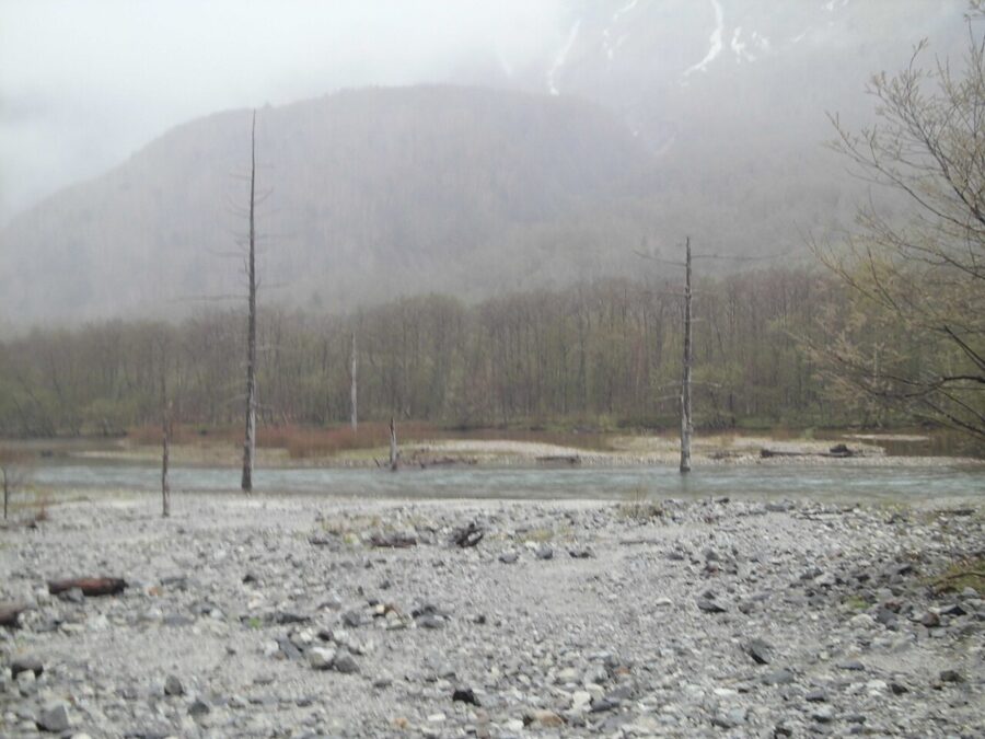
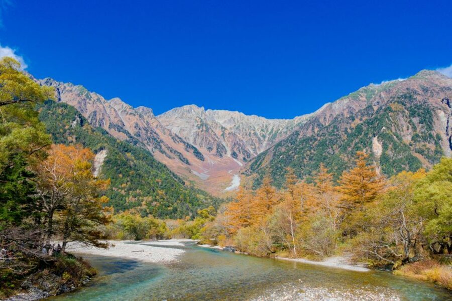
Kamikochi is a flat valley at 1,500 meters in the Northern Alps, with the clear Azusa River running through it and the Hotaka peaks above. Taisho Pond, at the entrance, was made in 1915 when Mount Yake erupted and dammed the river; the dead trees still stand in it. The classic walk runs from the pond to Kappa-bashi bridge, about an hour on the flat.
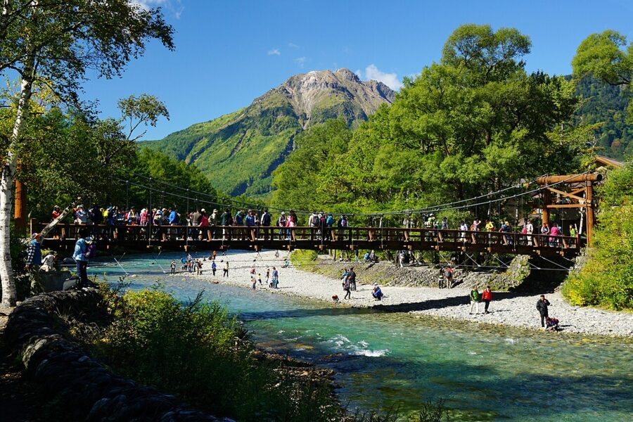

No private cars are allowed in. You park at Sawando on the Nagano side or Hirayu on the Gifu side and take a bus or taxi, or ride Alpico’s bus from Shin-Shimashima, at the end of the line from Matsumoto.
The 2026 season ran from April 17 to November 15, so the valley is shut until late April 2027. Mid-October is the time for larch gold; early June has fresh green and few people. Order grilled iwana char at the riverside lodges.

The snow wall at Murodo, and Kurobe Dam
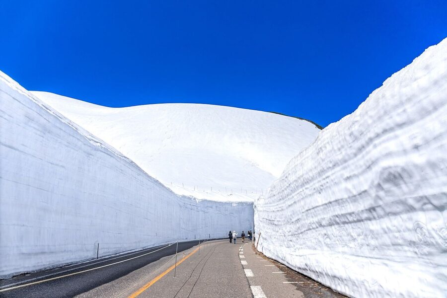
The Tateyama Kurobe Alpine Route crosses the Northern Alps between Toyama and Nagano by cable car, bus, ropeway and electric bus, and it opens each spring by cutting a road through the snow. Near Murodo, at 2,450 meters, the cut leaves walls of snow on both sides, the Yuki-no-Otani (雪の大谷). In 2026 the wall measured 12 meters, and the walk between them ran from the April 15 opening to June 25.

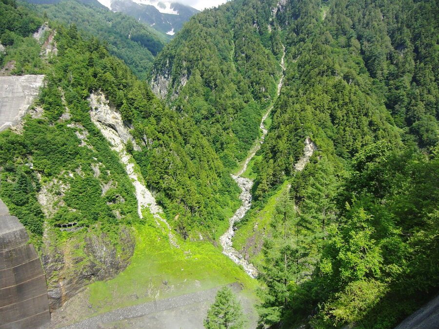
The route’s other end is Kurobe Dam, 186 meters high, which sprays more than ten tons of water a second into the gorge every day from June 26 to October 15. The route is planned to open again on April 15, 2027 and run to November 30. A one-way crossing with stops takes most of a day; from the Nagano side, the electric bus from Ogizawa to the dam alone takes 16 minutes and costs ¥1,800 (about $12).

Shirakawa-go
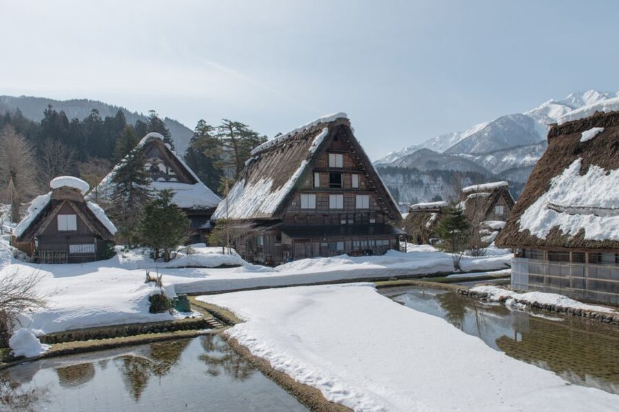
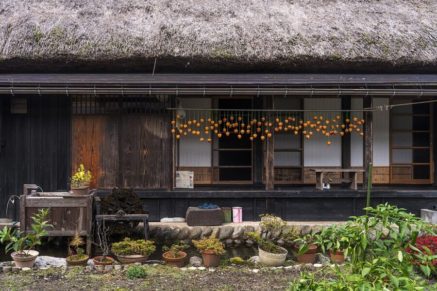
Ogimachi, the main village of Shirakawa-go, is a valley of steep-roofed farmhouses in the gasshō-zukuri style, their thatch pitched like hands pressed together in prayer so the snow slides off. It has been a World Heritage site since 1995, and its roofs are rethatched by the community, a few houses a year. Come in late October for the harvested fields, or in snow.
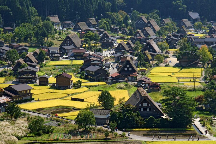

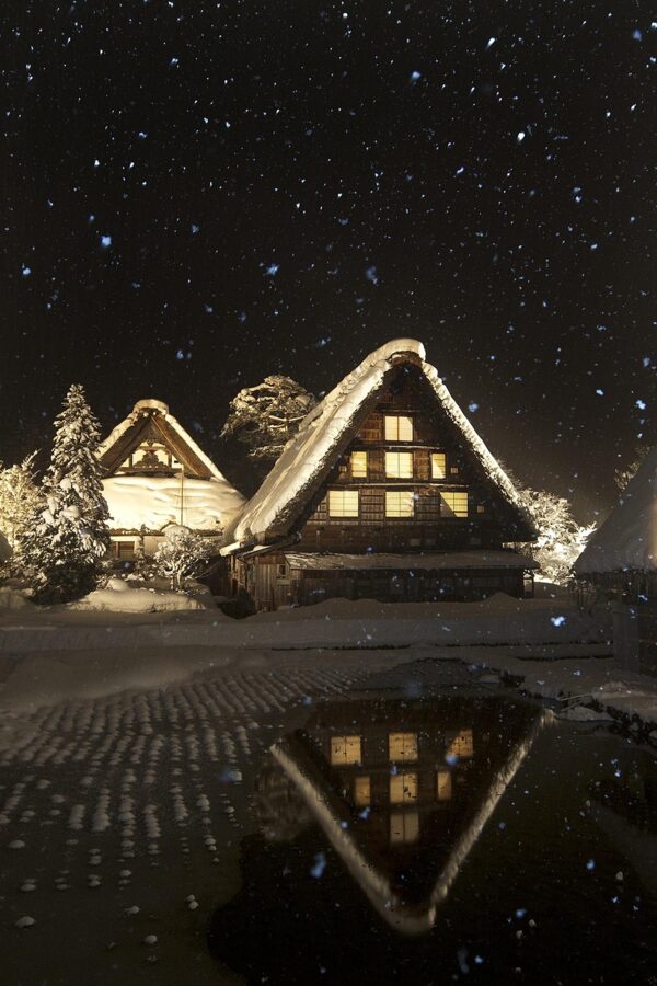
The snowbound evening light-up is the most famous sight here, and it is now booked out months ahead. In 2027 it runs on four evenings, January 11, 17, 24 and 31, and you can only get in with a booked car park, a room in the village, or a seat on a bus or tour; the first round of car park bookings has already sold out.
Ordinary days are easier. Nohi buses run from Takayama in about 50 minutes and from Kanazawa in about 75. Eat hoba miso, miso grilled on a magnolia leaf.

Kiyotsu Gorge Tunnel
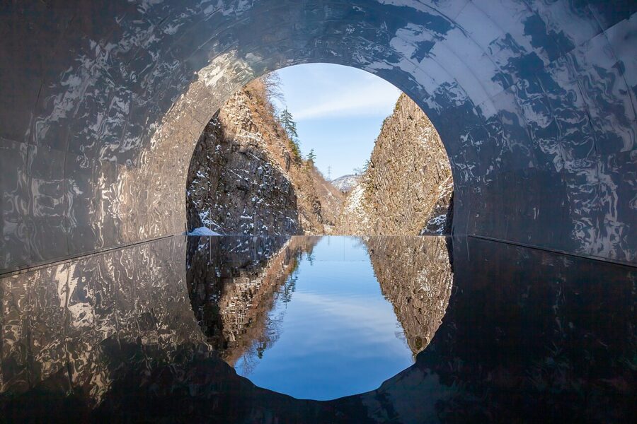
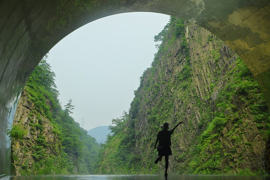
Kiyotsu Gorge in Niigata is one of Japan’s three great gorges, a deep cut through columnar basalt, and after a rockfall closed the old cliff path in 1988, a 750-meter walking tunnel was opened in 1996. In 2018 an artist’s makeover for the Echigo-Tsumari Art Field turned the last viewing chamber into a shallow pool that mirrors the gorge through the tunnel mouth. That photo is now more famous than the gorge.

Entry is ¥1,200 (about $8) from April 21 to November 20 and ¥1,000 (about $7) in the off-season, and at Golden Week, Obon and event times it is open to advance bookings only. The tunnel can close for snow in winter. Buses from Echigo-Yuzawa Station, on the Joetsu Shinkansen, take about 25 minutes, then a walk of up to half an hour from the stop. Mid-October to early November brings the gorge color; go on a weekday.

Shiroyone Senmaida, Wajima
On the Noto Peninsula, 1,004 tiny rice paddies step down a slope into the Sea of Japan at Shiroyone. The New Year’s Day earthquake of 2024 cracked many of them, and floods followed that September. Volunteers and the people who sponsor paddies have kept planting: children planted rice here in May 2026, and owners cut it by hand that September.
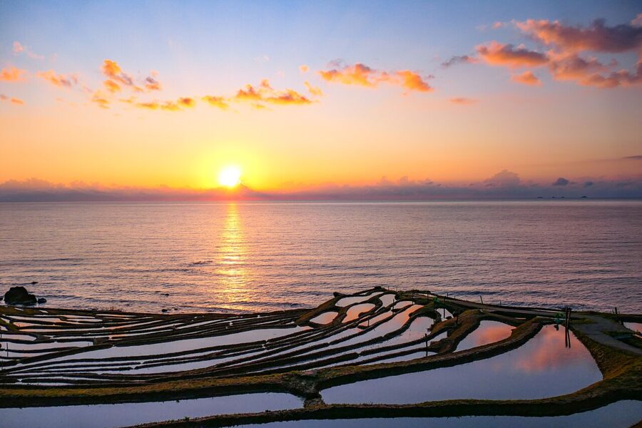

The best months are May, when the flooded paddies hold the sunset, and September for harvest gold. Noto is still rebuilding, so go as a visitor who spends money: stay in Wajima or Kanazawa, and the terraces are about 20 minutes’ drive east of Wajima. Check the city’s current notices before you set out.
Kansai and the Kii Peninsula
Kyoto, Osaka and Nara are where most first trips go, and the most beautiful places are an hour or two beyond them.
The Hozu Gorge, from Kameoka to Arashiyama
Arashiyama, on Kyoto’s western edge, is beautiful and swamped. The better way to see it is to arrive by the river. Wooden boats worked by a crew of boatmen leave Kameoka and take about two hours to come down the Hozu Gorge, through rapids and under steep forest, to the Togetsukyo bridge in Arashiyama.
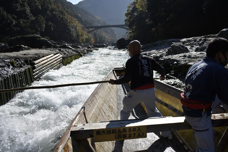

The boats run all year except for breaks and high water; this season runs until March 9, 2027, with four boats a day from December 14. Late November is peak color. From March to December the Sagano Romantic Train runs up the same gorge, so you can ride up and float back down.
Yoshino
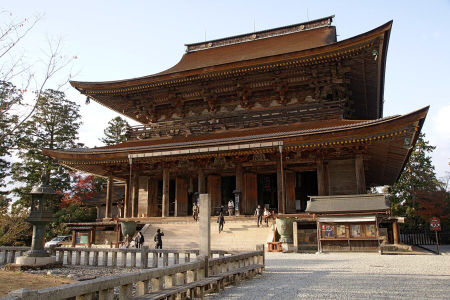
Mount Yoshino, in the hills south of Nara, has about 30,000 cherry trees, most of them wild mountain cherries planted over many centuries as offerings to the mountain’s temples. They bloom in stages up the slope: the lower and middle groves in early April, the upper ones a few days later, and the innermost, Oku-senbon, around mid-April.
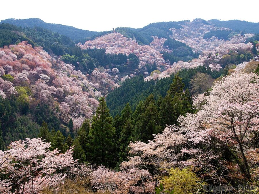

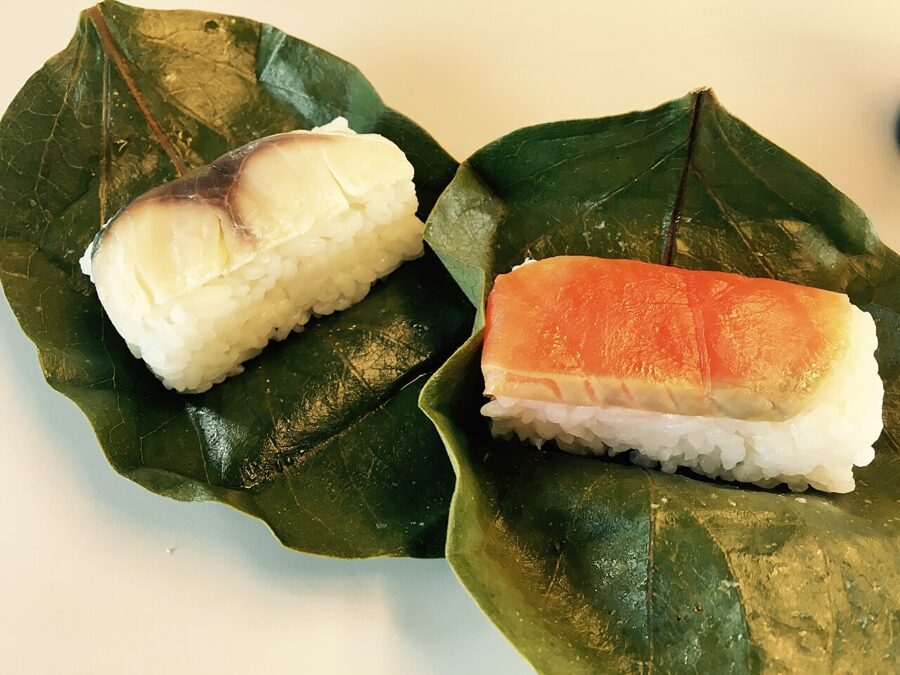
Weekends at peak are jammed, and the narrow ridge road is one long queue. Go on a weekday and start at the top, taking the bus up and walking down. Kintetsu trains from Osaka Abenobashi reach Yoshino Station in about 80 minutes by limited express. Try kakinoha-zushi, mackerel sushi pressed in persimmon leaves, the local food.


Nachi Falls
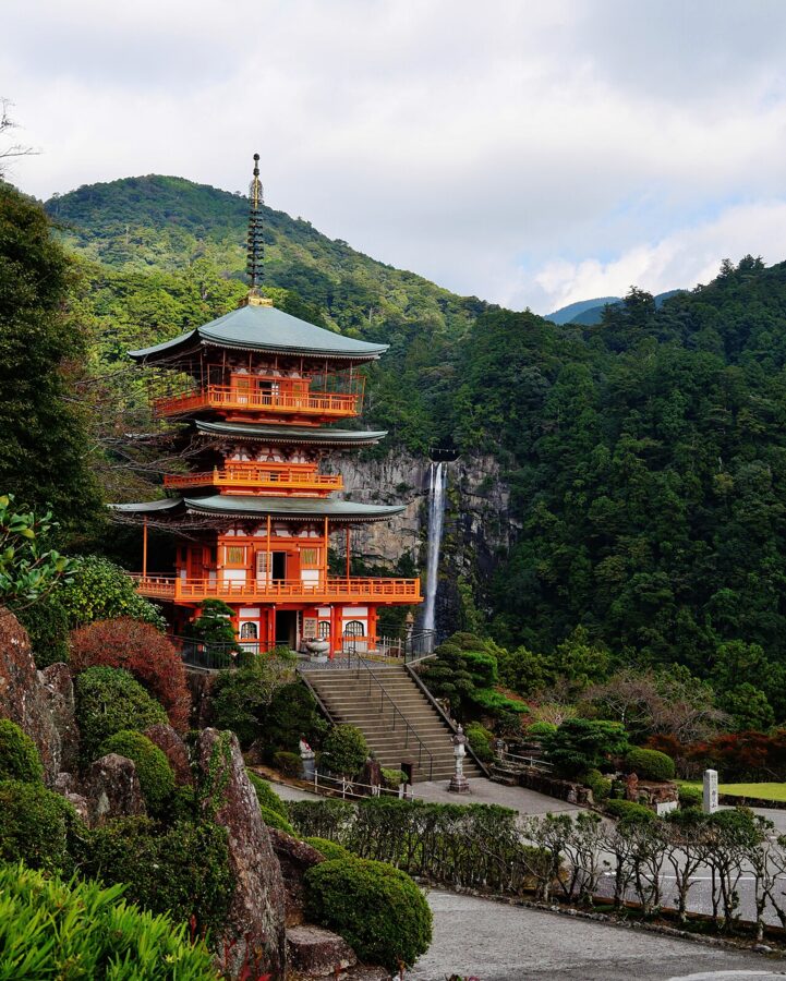
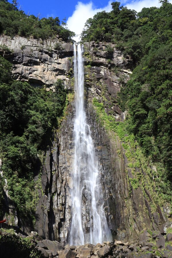
Nachi Falls drops 133 meters in one clean column, the longest single fall in Japan, and it has been worshipped as a god since before the shrines were built around it. The view everyone knows pairs it with the red three-story pagoda of Seigantoji temple, standing on the slope opposite.

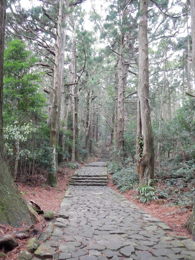
Any season works, and the fall is strongest after the June rains. From Kii-Katsuura Station, buses take about half an hour to the falls. For the full approach, get off early at Daimonzaka and climb the cedar-lined stone steps of the Kumano Kodo pilgrimage route, about half an hour uphill. Katsuura is a tuna port, so eat tuna at lunch.

Himeji Castle
Himeji is the finest of the dozen castles whose keeps survive from the samurai era, a white tower finished in 1609 on a hill in the middle of the city. Cherry blossom in early April puts it at its best, and also at its most crowded. From March 2026, Himeji charges visitors from outside the city ¥2,500 (about $17) to enter, residents ¥1,000, and under-18s nothing.
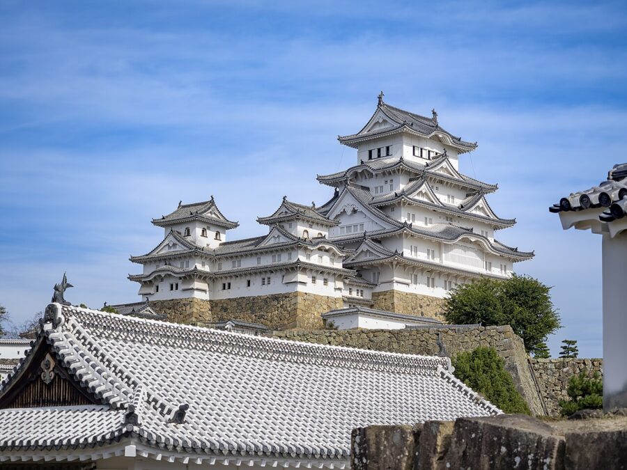

It opens 9 a.m. to 5 p.m., with last entry at 4, and closes only on December 29 and 30. A combined ticket with Kokoen garden next door costs ¥2,600 (about $17), and the garden in autumn is worth the extra ¥100.
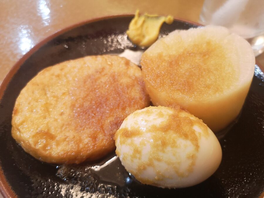
Himeji is 30 to 40 minutes from Shin-Osaka by Shinkansen. Eat Himeji oden before you leave.

Takeda Castle ruins
Only the stone walls of Takeda Castle remain, laid along a 354-meter ridge above the town of Asago. On cold, clear autumn mornings, mist fills the valley and the walls seem to float on cloud. You see that from Ritsuunkyo, a viewpoint on the mountain across the valley, not from the castle itself.
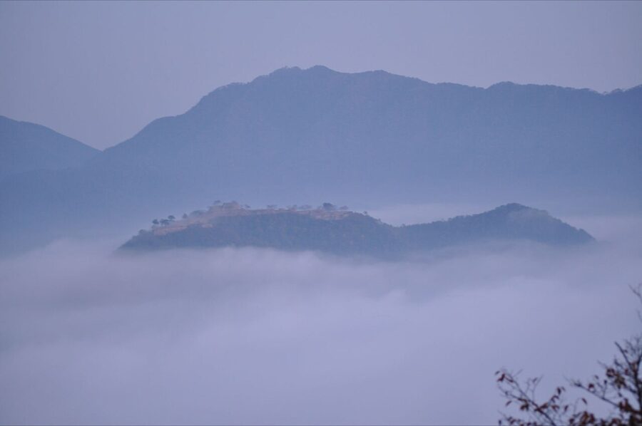

Entry is ¥500 (about $3). From June to early December the ruins open at 5 a.m.; after that hours shorten, and they close from January 4 to the end of February. To see the clouds, stay the night in Takeda and start before dawn. JR Takeda Station is about two and a half hours from Osaka.
West to the Sea of Japan, and across to Shikoku
Itsukushima Shrine, Miyajima
The great torii of Itsukushima stands in the sea off Miyajima, and at high tide the shrine’s halls behind it seem to float. At low tide you can walk out to it across the sand. The current gate dates from 1875, and its latest repair ended in late 2022.
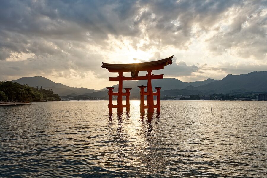

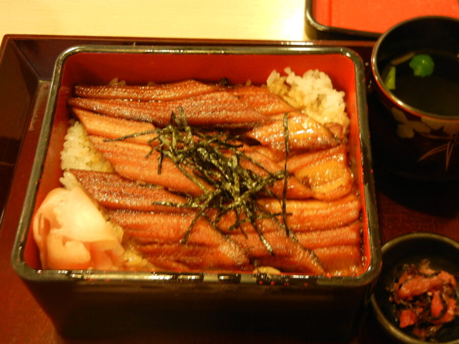
Ferries from Miyajimaguchi take 10 minutes and cost ¥200 (about $1) each way, plus a ¥100 (under $1) visitor tax on the way over. The JR ferry passes closest to the torii. Day-trippers fill the island from late morning, so stay overnight or arrive by 8. Eat grilled oysters in winter, or anago-meshi, conger eel on rice, anytime.

Motonosumi Shrine and Tsunoshima Bridge
At Motonosumi Shrine in Nagato, 123 red torii run down a green cliff to the Sea of Japan. The shrine is small and remote, and it became famous from photos almost overnight. In 2026 it suspended worship on weekends and holidays from March to November, except some September weekends, and the torii are under repair: you cannot walk through them until spring 2027 or later. Check its notices before making the trip.
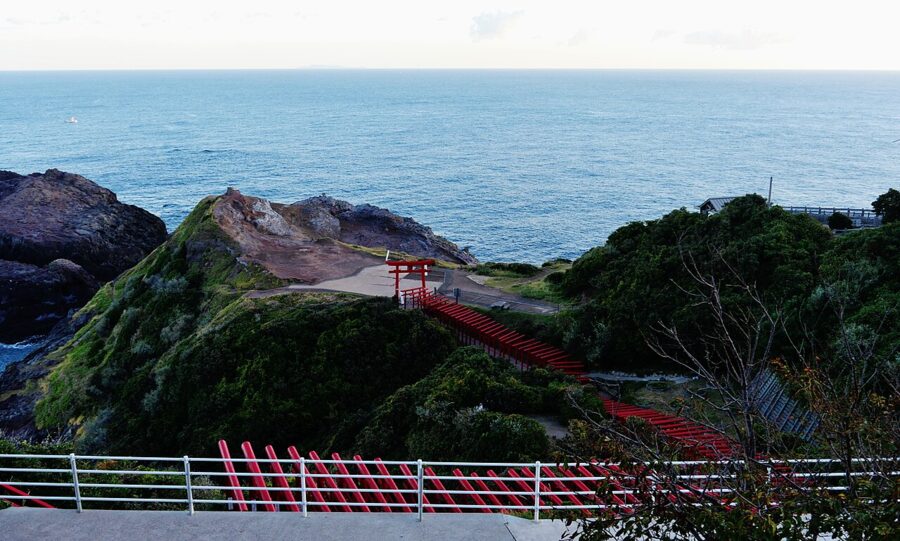

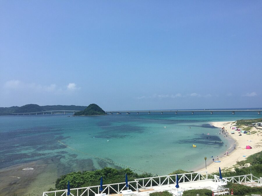
It is a car trip: a taxi from JR Nagato-Furuichi or Hitomaru takes about 20 minutes. Parking is ¥300 (about $2) for the first hour, at most ¥500. Pair it with Tsunoshima Bridge, under an hour’s drive away, which runs 1,780 meters across turquoise water to a small island.

Chichibugahama, Mitoyo
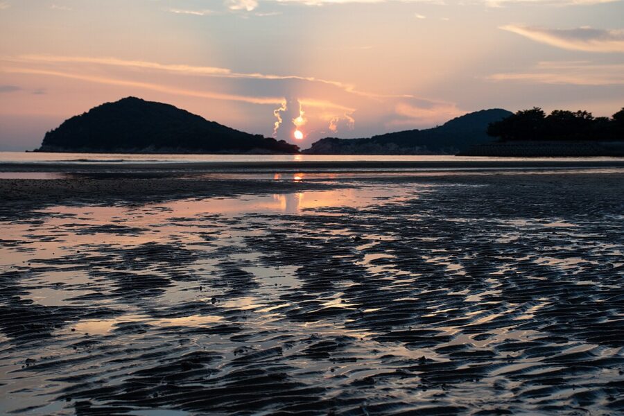
Chichibugahama is a long, flat beach on the Seto Inland Sea in Kagawa. When a low tide falls near sunset and the wind drops, the wet sand reflects the sky like a mirror, and people pose on it for silhouettes. The conditions line up only a few evenings a month, and the city’s tourism office publishes a calendar of the likely dates.
Buses from JR Takuma Station are few, so most people take a taxi, about 20 minutes. Spring and summer have the warmest evenings and the latest sunsets. You are in udon country: eat Sanuki udon at lunch somewhere inland.
The Iya Valley vine bridge
Deep in the mountains of Tokushima, the Iya Valley was once so remote that the only way across its river was a bridge woven from mountain vines. The Iya Kazurabashi still crosses it, 45 meters long and 14 meters above the water, rebuilt every three years, with gaps between the slats wide enough to see the river through.
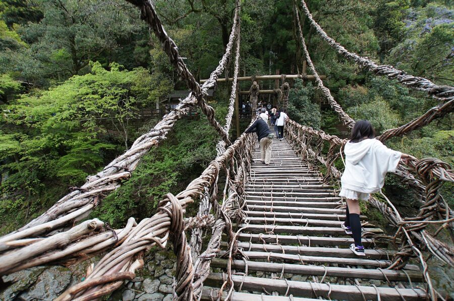

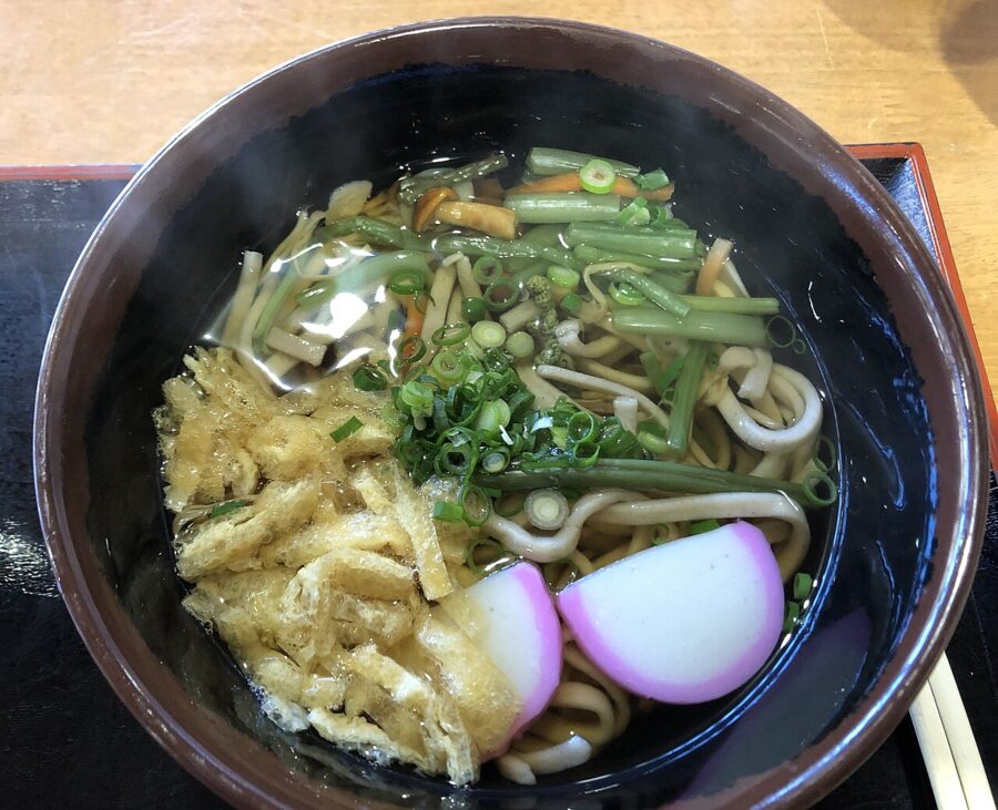
It is about 20 minutes by bus or 15 by taxi from JR Oboke Station, and buses are few. Mid-November brings the color. Iya soba, a coarse buckwheat noodle, is the dish.

Kyushu and the far south
Takachiho Gorge
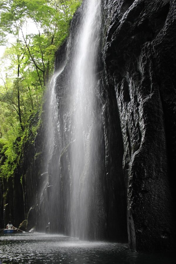
In the mountains of Miyazaki, the Gokase River cuts a narrow gorge through basalt left by ancient eruptions of Mount Aso, with cliffs of 80 to 100 meters and Manai Falls dropping into the green water. You can walk the rim path in about half an hour, or rent a rowing boat and go under the fall.
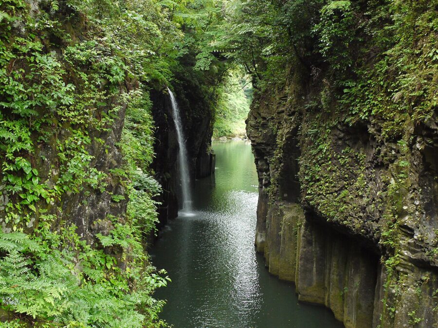

Summer is the busiest, for the boats. Late November is quieter, with color on the cliffs. There is no railway: buses come from Kumamoto in about three hours and from Nobeoka in about an hour and a half, so plan to stay in Takachiho town and see the evening kagura dance at the shrine.
Shiratani Unsuikyo, Yakushima
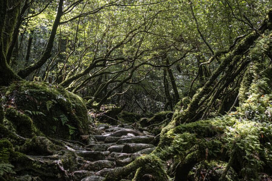
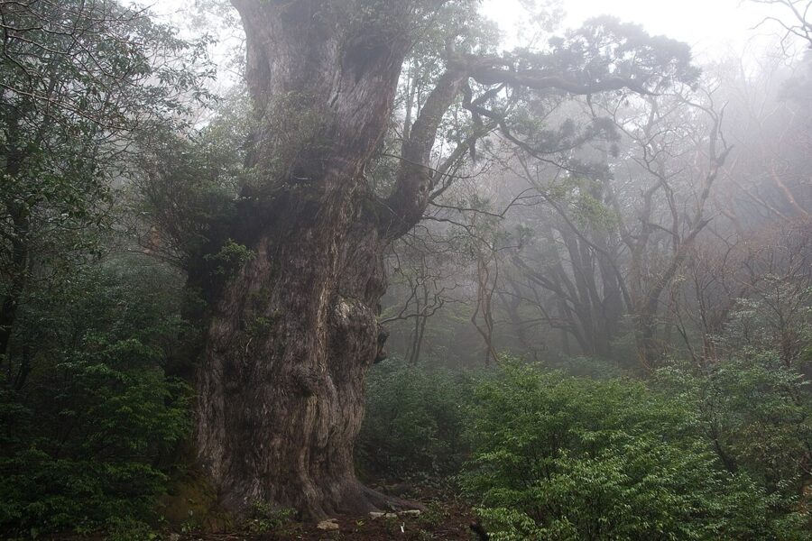
Yakushima, an island off southern Kyushu, is wet enough that moss covers almost every surface in its cedar forests. Shiratani Unsuikyo is the easiest of those forests to reach: a stream valley with boardwalks and trails, about 40 minutes by bus from the island’s main port. A half-day loop takes you to the moss forest; the full day hike on to Jomon Sugi, the island’s oldest cedar, is about ten hours from another trailhead.
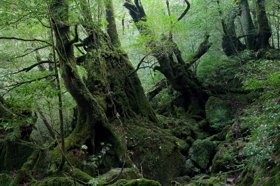

Spring and autumn avoid both the June rains and the summer typhoons. High-speed ferries from Kagoshima take two to three hours. Wear boots and expect rain whatever the forecast says.

Kabira Bay, Ishigaki
Kabira Bay on Ishigaki Island, far south in Okinawa, is a bowl of turquoise water dotted with small green islands, and it is designated a national Place of Scenic Beauty. Swimming is not allowed, because of currents and the boat traffic. Look at it from the shore at Kabira Park, then take a glass-bottom boat over the coral.
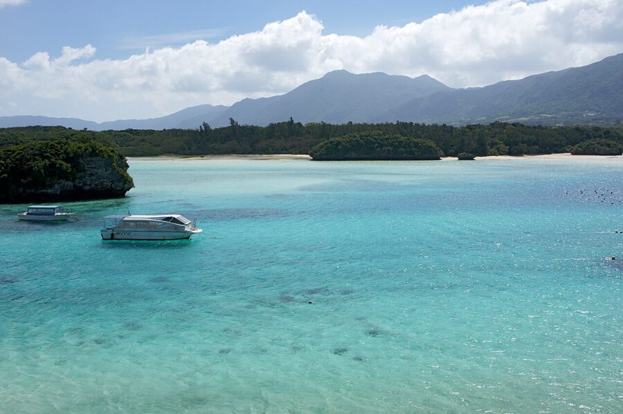

Go from April to June, before the peak of summer and the typhoon season. Buses from the island’s ferry terminal take about 40 minutes.
A year of it, month by month
| When | Where |
|---|---|
| January–February | Zao snow monsters, Ginzan Onsen, Shirakawa-go light-up, Blue Pond light-up |
| Early–mid April | Yoshino, Himeji, Chureito Pagoda (crowded), Kabira Bay |
| Late April–May | Hitachi nemophila, Yuki-no-Otani snow wall, Shiroyone Senmaida at planting, Kamikochi opens |
| June–August | Kurobe Dam discharge, Blue Pond, Chichibugahama, Takachiho boats, Tsunoshima Bridge |
| September–October | Shiretoko, Hitachi kochia, Takeda’s sea of clouds, Kamikochi, Shiroyone harvest |
| Late October–November | Oirase, Kiyotsu Gorge, Chureito Pagoda, Hozu Gorge, Iya Valley, Kamakura Alps |
Which ones go together
Most of these work as single stops on a wider trip. A few chains make whole itineraries.
Yamagata in winter. Zao and Ginzan Onsen sit on the same Yamagata Shinkansen line from Tokyo: Zao from Yamagata Station, Ginzan from Oishida, about 40 minutes further north. Spend one night at each.
Over the Alps. Start in Kanazawa for Shiroyone Senmaida, take the bus to Shirakawa-go and on to Takayama, then cross to Matsumoto through Kamikochi. Or take the Alpine Route from Toyama past the snow wall and Kurobe Dam to Nagano. Between late April and mid-November, that is a week of the best mountain country in Japan.
Kansai beyond Kyoto. From Kansai Airport, the Rapi:t reaches Namba in under 40 minutes.
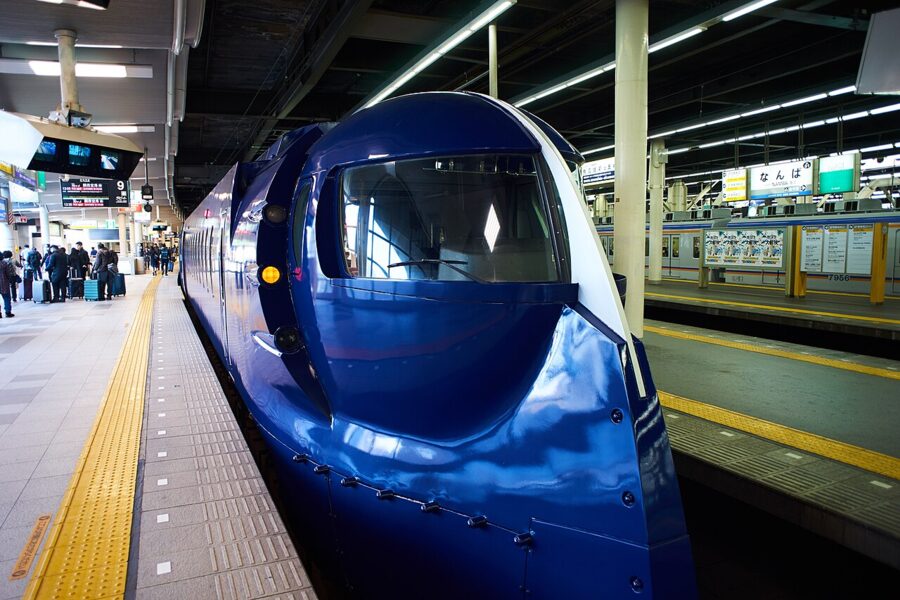

Base yourself in Osaka for Himeji and Takeda one day, Yoshino another, and the Hozu Gorge into Arashiyama a third. Nachi needs two days of its own, best walked in on the Kumano Kodo.
The Inland Sea and Shikoku. Miyajima, then west to Nagato for Motonosumi and Tsunoshima, or back east and across the Seto Ohashi Bridge to Chichibugahama and the Iya Valley. Both need a rental car for the last stretch.
And if you can only do one of the famous views on this list, do it at an hour when nobody else is there. Chureito at sunrise in November has the same Fuji as Chureito in April. It also has the steps to itself.