

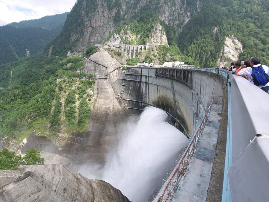
From June 26 to October 15, Kurobe Dam throws more than ten tons of water a second out of its face, and when the wind comes up the gorge the spray climbs all the way back to the crest. On a sunny morning a rainbow sits in it. The dam is 186 meters tall, the tallest in Japan, and no private car can reach it.
That last fact shapes the whole day. You arrive by electric bus through a tunnel from Nagano, or by a chain of cable cars, buses and a ropeway over the Tateyama range from Toyama. Both approaches are part of the Tateyama Kurobe Alpine Route (立山黒部アルペンルート), a 37.2-kilometer mountain crossing that opens in mid-April and shuts on November 30.

Contents9 sections
- What Kurobe Dam is, and what it took to build
- The season: when the route opens and when the water flies
- Getting there from the Nagano side
- Through the whole Alpine Route
- Tickets, timed boarding and luggage
- At the dam: a route around the viewpoints
- Dam curry, and what else to eat
- How long to allow, and where to sleep
- Pairing it with the snow walls or Kamikochi
What Kurobe Dam is, and what it took to build
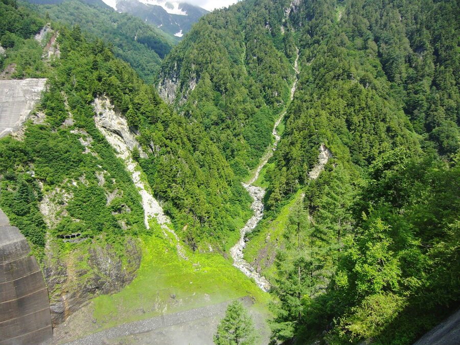
Kurobe Dam (黒部ダム) holds back the upper Kurobe River in Tateyama Town, Toyama Prefecture, about three kilometers west of the Nagano border. Kansai Electric Power built it to feed the Kurobe River No. 4 Power Station, ten kilometers downstream and inside the mountain, which is why people still call the dam Kuroyon (黒四), “Kuro Four.” The electricity goes to the Kansai region around Osaka and Kyoto, not to Toyama.
The project was a postwar emergency. Kansai in the early 1950s lived with scheduled power cuts several days a week, and the company decided the Kurobe gorge was the one site big enough to fix it. Work began in 1956, the dam started sending power in 1961 and was finished in June 1963. The cost was 51.3 billion yen, part of it borrowed from the World Bank, and Kansai Electric counts ten million worker-days and 171 lives lost.
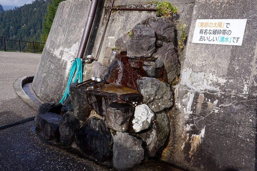
The hardest stretch was not the dam but the road to it. To bring in heavy machinery the builders dug a tunnel from the Nagano side, and partway through they hit a fracture zone (hasaitai, 破砕帯) where ice-cold water at 4°C and loose rock burst out at up to 660 liters a second. Getting through 80 meters of it took seven months and was finally done in December 1957. That tunnel is the one your bus uses today.

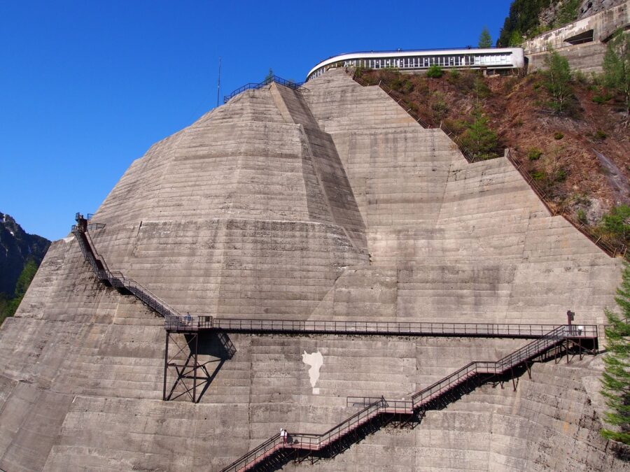
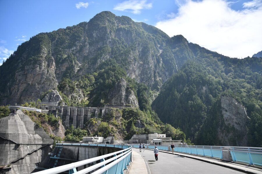
The design changed mid-build. The first plan was a plain arch, but after the Malpasset Dam in France failed in 1959, a fresh survey found the rock on both banks weaker than expected. The engineers added the two concrete “wings” at either end, gravity sections that sit on the rock by their own weight, and you can see them from the crest. The story reached a national audience in 1968 with the film Kurobe no Taiyō (黒部の太陽, “The Sun of Kurobe”), starring Toshirō Mifune and Yūjirō Ishihara.

The season: when the route opens and when the water flies
The Alpine Route runs from mid-April to November 30. In 2026 it opened on April 15, and the operators say it will reopen in mid-April 2027. In winter the whole line is buried and closed, and from December 1 even the road up to Ogizawa on the Nagano side shuts.
The sightseeing discharge (kankō hōsui, 観光放水) is a separate, shorter season. Its stated purpose is to keep the gorge below the dam looking like a river, and the water is sprayed as mist so the drop does not scour the riverbed. It runs every day from June 26 to October 15 and is continuous during the hours below, unless weather stops it.
Discharge hours
| Dates | Discharge hours |
|---|---|
| June 26 to July 31 | 6:00 to 17:30 |
| August 1 to September 10 | 6:30 to 17:00 |
| September 11 to October 15 | 7:00 to 16:30 |
These are the dam operator’s standing hours, and the 2026 season ran to October 15 as planned.
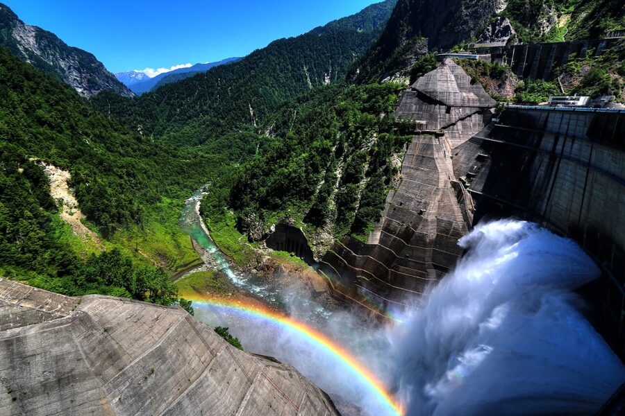

Spring, summer and autumn at the dam
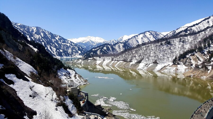
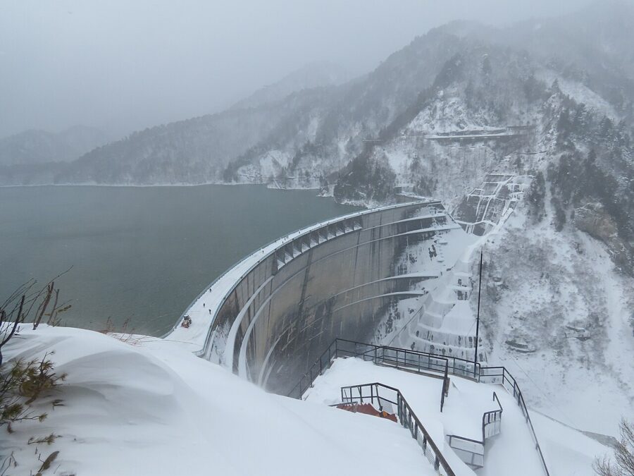
In late April and May the dam has no discharge, but the peaks around Lake Kurobe are still white, and the operator notes that the snowy Tateyama range stays in view from the dam until about late May. It is also snow wall season at Murodō, so the route is at its busiest. For the dam alone, spring is the weakest season.
Late June to mid-October is the discharge season, and I would aim for a weekday in July or September: July for the long hours, September for thinner crowds after the mid-August Obon peak. Rainbows need sun on the spray, so a clear morning is the target.
Autumn color around the dam usually runs from mid-September to late October. The operator describes a “three-tier” autumn, snow on the summits, red and gold on the slopes and green still below. In 2026 the leaves were late: the dam’s own staff posted that color was only patchy on October 7 and filled in by October 13, two days before the discharge stopped for the year.
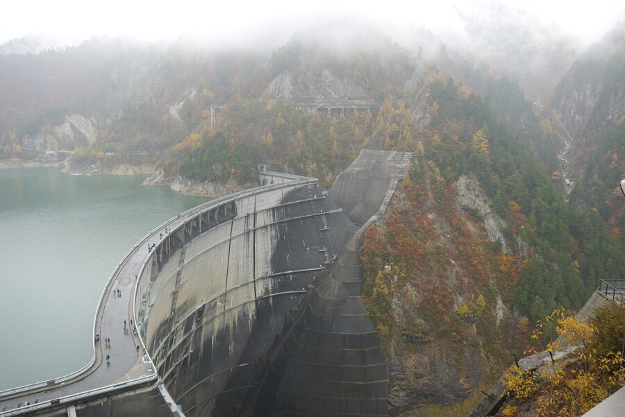

November is quiet and cold. The discharge is over, the first snow normally falls on Murodō in mid-October, and from early November a shorter winter timetable applies. On the Toyama side the Highland Bus can be suspended by snow in the second half of the month, so the operators advise entering from Ogizawa.

Getting there from the Nagano side
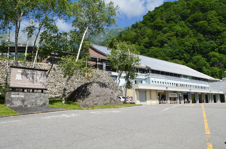
The quickest way to the dam is from Ogizawa (扇沢), a terminal at 1,433 meters in the hills above Ōmachi in Nagano Prefecture. From there the Kanden Tunnel Electric Bus reaches Kurobe Dam Station in 16 minutes. Getting to Ogizawa is the part that takes planning.
- From Nagano Station: Alpico’s express bus to Ogizawa leaves from the East Exit and takes about 100 minutes. In the 2026 season there were six buses a day, and the fare is ¥4,300 (about $29) one way. No reservation is needed.
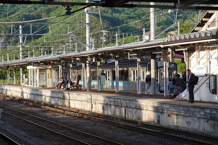
- From Shinano-Ōmachi Station: take the JR Ōito Line to Shinano-Ōmachi, then the local bus to Ogizawa, about 40 minutes for ¥2,000 (about $13). Buy the ticket before boarding, at Ogizawa or at the station.
- By car: drive to Ogizawa, about 60 minutes from Azumino IC on the Nagano Expressway or 90 minutes from Nagano IC. There are about 230 free and 350 paid spaces; vehicles over 2.1 meters wide, 5 meters long or 2.6 meters high must use the free lot.
Fares are as of the April 2026 revision. The road to Ogizawa, the Ōmachi Alpine Line, had roadworks with traffic controls in 2026, so allow extra time if you drive or take the bus in the morning rush.

Through the Kanden Tunnel
The Kanden Tunnel (関電トンネル) runs 5.4 kilometers through the mountain wall between Ōmachi and the dam, and the air inside sits around 10°C even in August. For 54 years trolleybuses ran this line. They were retired in 2018, and since 2019 the route has used battery buses that charge from an overhead pantograph at Ogizawa in about ten minutes.
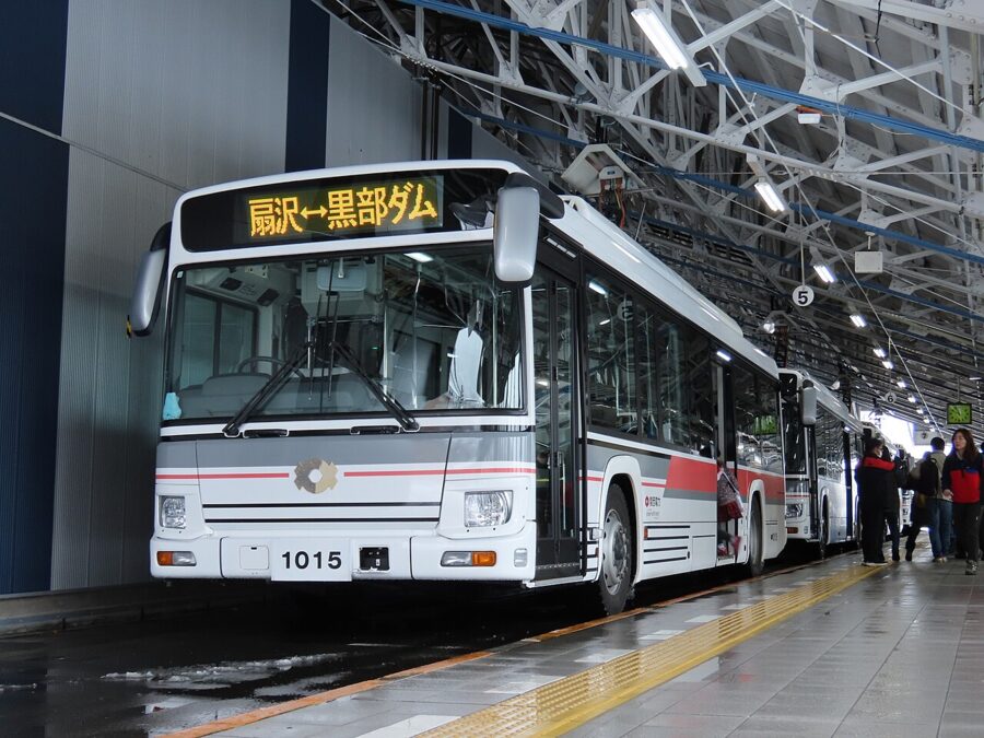

Watch the tunnel walls. The 80-meter fracture zone is marked with blue signs and lighting, and you can see water still running out of the rock. You cannot get off there on a normal ride; the only way to walk it is on a travel-company tour with an overnight stay.
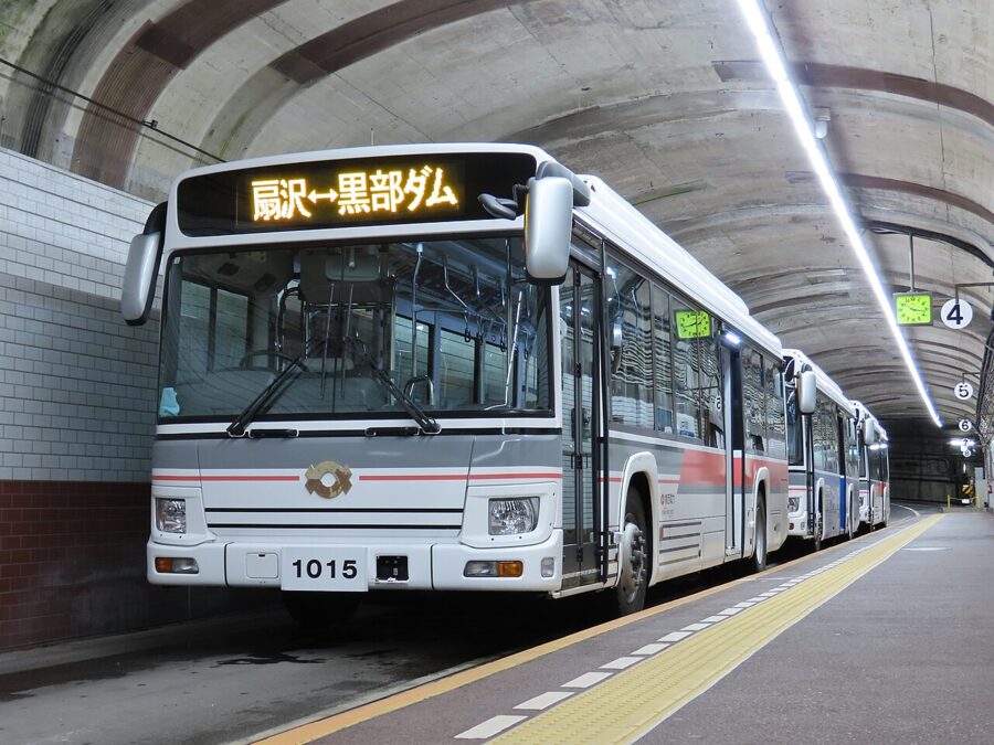

Ogizawa to Kurobe Dam costs ¥1,800 (about $12) one way or ¥3,200 (about $21) round trip for adults, with children at about half. Buses run every 30 minutes on the normal timetable, more often on busy days.
Through the whole Alpine Route
With a full day, make the dam the midpoint of a one-way crossing between Toyama and Nagano, using six vehicles between Tateyama Station and Ogizawa. The operator gives six to eight hours for the crossing with stops, and seven to eight hours from Dentetsu-Toyama in the city. One day is enough.
| Stage | Vehicle | Time | Adult fare, 2026 (one way / round trip) |
|---|---|---|---|
| Ogizawa to Kurobe Dam | Kanden Tunnel Electric Bus | 16 min | ¥1,800 / ¥3,200 |
| Kurobe Dam to Kurobeko | On foot across the crest | short walk | free |
| Kurobeko to Kurobedaira | Kurobe Cable Car | 5 min | ¥1,150 (about $8) / ¥2,080 (about $14) |
| Kurobedaira to Daikanbō | Tateyama Ropeway | 7 min | ¥1,700 (about $11) / ¥3,060 (about $20) |
| Daikanbō to Murodō | Tateyama Tunnel Electric Bus | 10 min | ¥2,200 (about $15) / ¥3,960 (about $26) |
| Murodō to Bijodaira | Tateyama Highland Bus | 50 min | ¥3,000 (about $20) / ¥5,400 (about $36) |
| Bijodaira to Tateyama Station | Tateyama Cable Car | 7 min | ¥1,090 (about $7) / ¥1,980 (about $13) |
Tateyama Station to Ogizawa comes to ¥10,940 (about $73) one way. Add the Toyama Chihō Railway from Dentetsu-Toyama to Tateyama, 65 minutes and ¥1,420 (about $9), and the bus from Ogizawa to Shinano-Ōmachi, and the full through fare from Dentetsu-Toyama to Shinano-Ōmachi is ¥14,360 (about $96) from April 15, 2026.
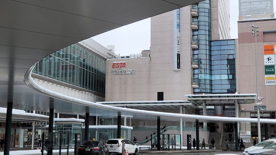
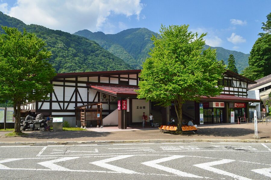
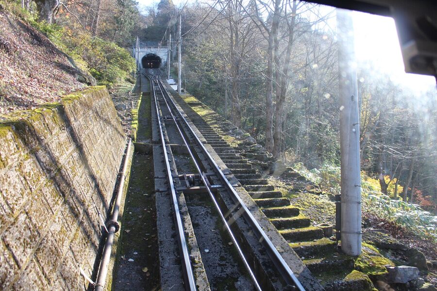

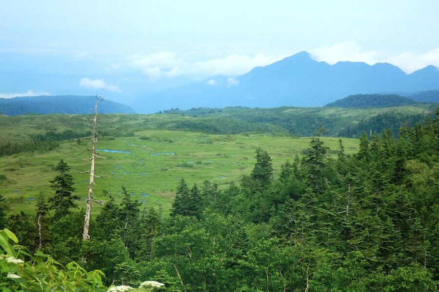
The Highland Bus from Bijodaira to Murodō is the long, scenic leg, climbing nearly 1,500 meters past the Midagahara wetlands. Every passenger rides seated, so if you get off at Midagahara or Tengudaira to walk, reserve your seat on a later bus at that stop before you set off.

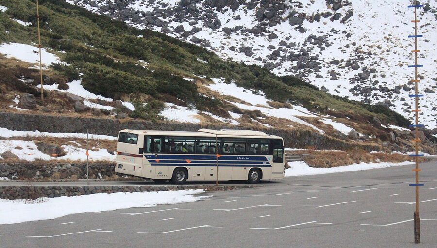

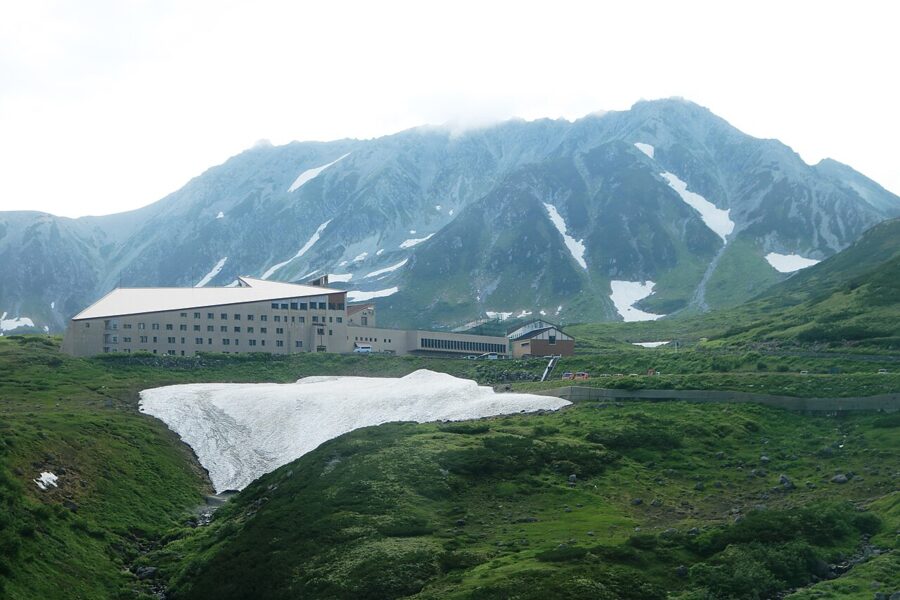
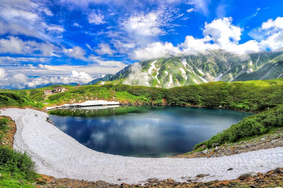
Murodō, at 2,450 meters, is the highest point on the route and the base for walks to Mikurigaike pond, about 15 minutes from the station. From there the Tateyama Tunnel Electric Bus runs 3.7 kilometers through the mountain under Mount Tate to Daikanbō. This leg was a trolleybus line until 2025, when it switched to battery buses.
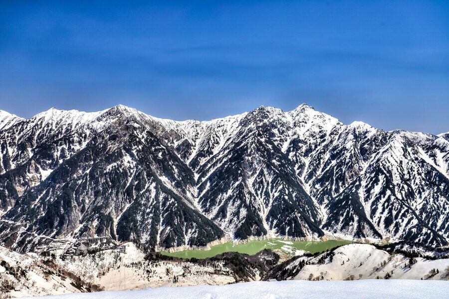

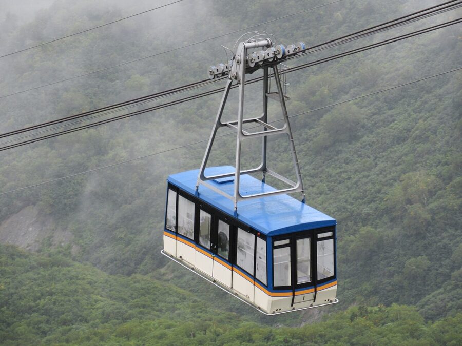
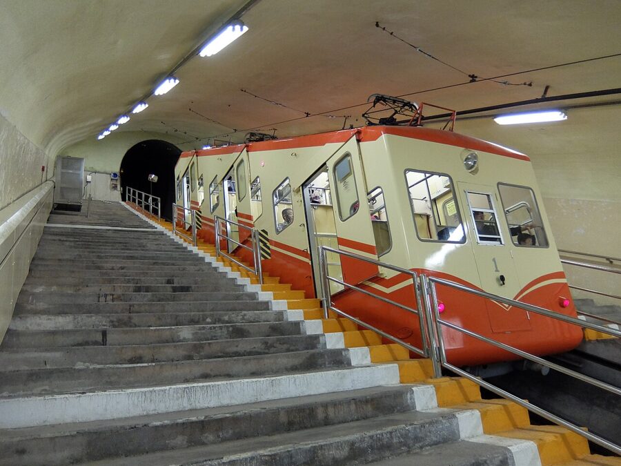
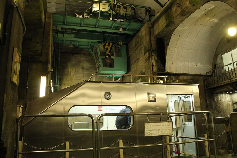
The Tateyama Ropeway drops about 490 meters from Daikanbō to Kurobedaira with no support towers between the two stations, the longest single span of its kind in Japan. Then the Kurobe Cable Car runs entirely underground for 0.8 kilometers down to Kurobeko, built inside the mountain to protect the national park scenery and to keep it safe from heavy snow. From Kurobeko a passage leads out onto the left bank of the dam.


One newer way in: since October 2, 2026, the Kurobe Unazuki Canyon Route has opened the old Kansai Electric works route from Keyakidaira, at the end of the Kurobe Gorge trolley train, through the power station tunnels to Kurobe Dam. It is sold only as guided tours through travel agencies, with about 2,700 places in its first season, so you cannot buy a ticket for that section alone.

Tickets, timed boarding and luggage
Only two departures on the route need a boarding time: the Tateyama Cable Car leaving Tateyama Station, and the Kanden Tunnel Electric Bus leaving Ogizawa. Everywhere else you queue at the gate and take the next car.
Do you need to book? For a weekday visit to the dam from Ogizawa, no. For the snow wall weeks, Golden Week, mid-August or an autumn holiday weekend, book.
Web tickets and same-day tickets
The official Web Ticket site (立山黒部アルペンルートWEBきっぷ) lets you buy in advance and pick your boarding time at Tateyama or Ogizawa. You register with an email address, pay by credit card (debit and prepaid cards are not accepted), and get a QR code. Collect the paper ticket from a machine at Ogizawa, Tateyama or Dentetsu-Toyama, from noon the day before travel; in busy periods the operator asks you to arrive 30 minutes early and collect it at least 15 minutes before your time.
Same-day tickets are sold only on the day you travel, at the station windows, for cash or credit card. Windows open 20 minutes before the first departure at Tateyama and 40 minutes before at Ogizawa. On the busiest days sales of some sections or same-day round trips can be restricted, and if web tickets are sold out the window still sells tickets but your preferred boarding time may be gone. Tickets stay valid for five days if you stop overnight on the route.
Passes
The national Japan Rail Pass does not cover the Alpine Route, which is run by private companies. Two regional products do: the Alpine-Takayama-Matsumoto Area Tourist Pass for overseas visitors, and the new Tateyama Kurobe Alpine Free Kippu from JR Central, launched for 2026 from Nagoya. Even with a pass you still need a boarding time for the two timed departures.
Sending your bags ahead
The cable cars, ropeway and station stairs are no place for a suitcase, and coin lockers on the route will not take large bags. The Alpine Porter Service (アルペンポーターサービス) carries luggage the same day between Dentetsu-Toyama Station and Shinano-Ōmachi Station for ¥4,000 (about $27) per piece, cash only, with no booking needed. In 2026 it ran from April 15 to November 8.
- Dentetsu-Toyama: drop off 5:00 to 10:00, collect 15:30 to 18:00.
- Shinano-Ōmachi (counter in front of the station): drop off 7:40 to 10:30, collect 15:00 to 17:45.
- Guests at listed hotels near Tateyama Station and in Ōmachi Onsen can hand bags over at the hotel by 8:30 and pick them up after 16:30.
If you are taking the express bus from Ogizawa straight to Nagano, the bus does not stop where the bags arrive in Ōmachi, so read the operator’s Nagano instructions before you hand anything over. Drivers can also have a car moved from Ogizawa to Tateyama Station, or the reverse, by one of five car-forwarding companies, which takes about five hours.
At the dam: a route around the viewpoints
The dam has five main viewpoints and they run in a loop, so the order you take them in decides how much climbing you do. The operator suggests two loops: a 110-minute version that starts by climbing to the observation deck, and a 90-minute one that starts on the crest and skips the 220 steps.
I would take the long loop from the Nagano side. Climb first while your legs are fresh, then let gravity do the rest.
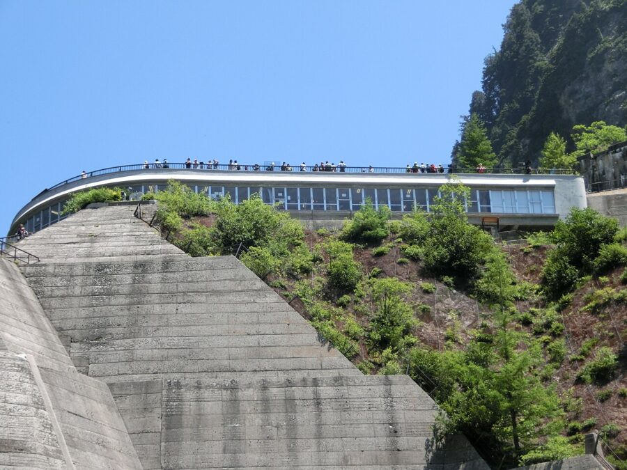
Observation deck and exterior stairs
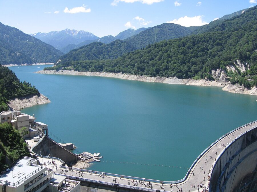
From the deck you see the whole arch, the discharge and Lake Kurobe running up the valley toward the Tateyama peaks. The dam’s staff recommend it in the morning for photos, and on a lucky day for a double rainbow. Then take the exterior stairs (外階段) down the rock face; each landing gives a different angle on the wall.

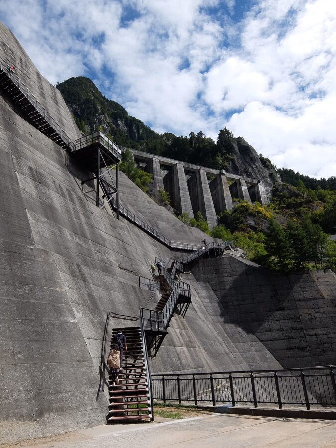

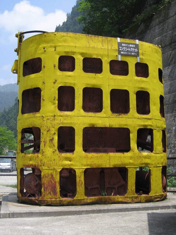
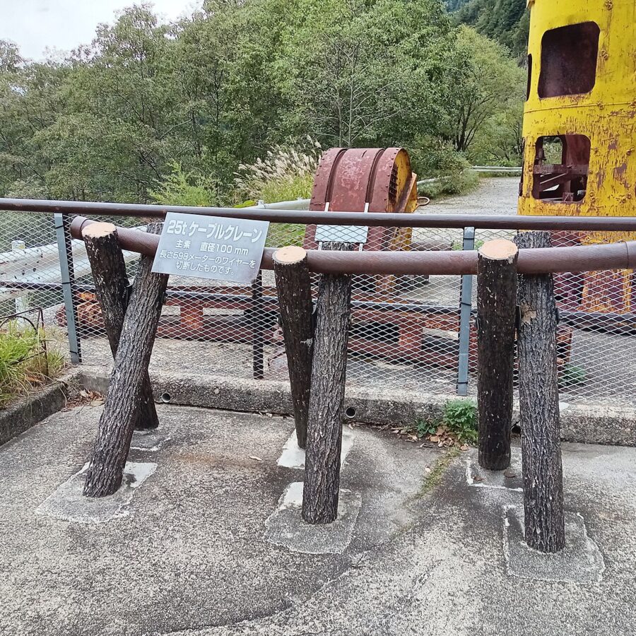
Partway down, the stairs pass a yellow concrete bucket and a pulley from the construction years, both part of the cable crane system that swung concrete across the gorge. They are easy to miss.

New Observation Plaza and Rainbow Terrace
At the foot of the stairs, the New Observation Plaza (新展望広場) and the Rainbow Terrace below it are the closest you can get to the discharge, looking up at the plume from slightly below crest level. When the wind turns, the mist drifts over the terrace like a cold shower. The plaza has benches, and a monument called Wadachi keeps the tire tracks of a 20-ton construction dump truck and the footprints of workers.
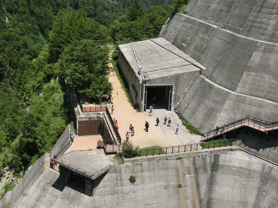
The plaza also has a seasonal hall, usually open from early May to late October, with panels and film on the construction and a full-size replica of the tunnel set from Kurobe no Taiyō, moved here from the Ishihara Yūjirō memorial museum. The set is 3.3 meters high and 4.4 meters wide.
Discharge Viewing Stage and the crest
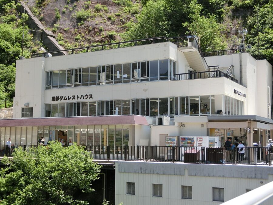
The Discharge Viewing Stage (放水観覧ステージ) juts out from the cliff at about crest height, and it is the step-free viewpoint: a slope runs to it from the front of the Rest House, so wheelchairs and strollers can get there. Ogizawa Station has the only elevator; at Kurobe Dam Station there are slopes to the dam, and the station lends a small number of wheelchairs, first come, first served.
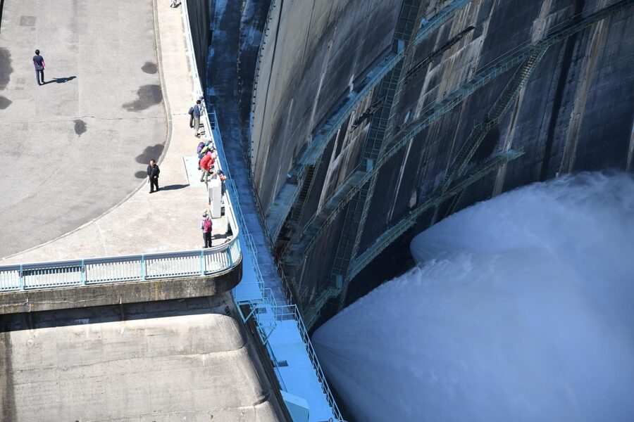
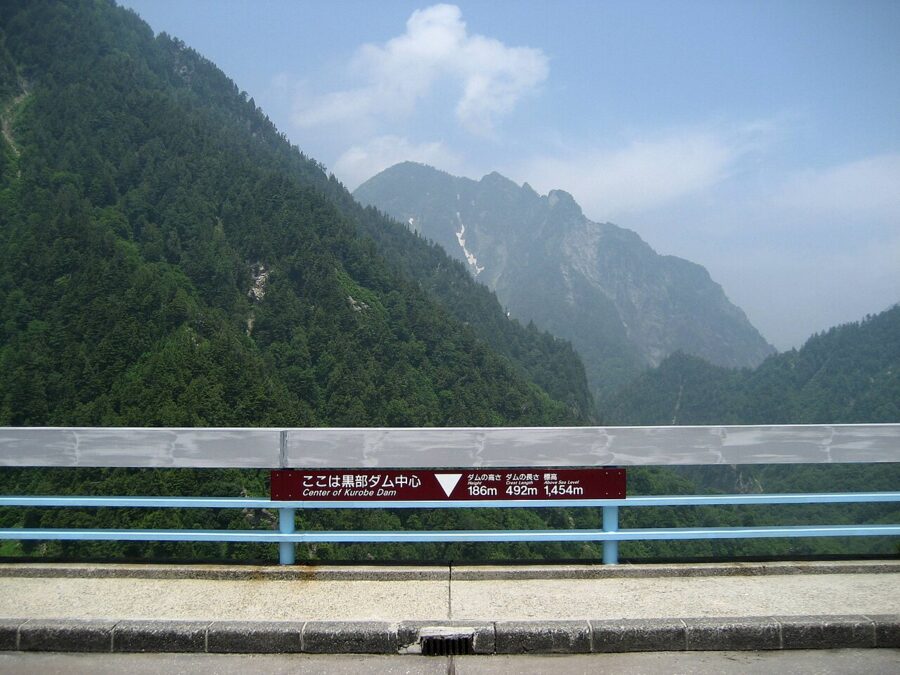
The crest itself is 492 meters long, and a marker shows its exact center. The views from the right and left banks differ, so walk the whole length. Near the right-bank end stands the memorial to the 171 people who died building the dam.

The lakeside path, and the boat that is gone
Past the left bank a lakeside path (湖畔遊歩道) crosses the Kanpadani suspension bridge and follows Lake Kurobe through beech and birch forest. It is flat and easy for children, and turning around at the Lodge Kuroyon mountain hut makes a walk of about an hour. Beyond it, the trail needs hiking gear.
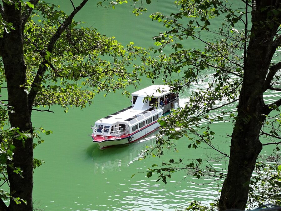
The Garbe (ガルベ) sightseeing boat no longer sails on Lake Kurobe. Its operator ended the service after November 10, 2024, citing falling passenger numbers and an aging boat.

Bad weather has its own plan. On rainy days the Rest House plays discharge footage on a 165-inch screen, and the plazas and stairs may close in high wind. Drones are banned at the dam.
Tours by lottery
Each summer the dam runs a few small guided events, each for about ¥1,000 (about $7) plus your bus fare, with places drawn by lottery. In 2026 there was a history tour to construction remains normally off-limits on July 24 and 25, a guided lakeside walk on September 6 and a night tour for stargazing on the crest on September 11. Applications open about six weeks ahead on the dam’s official site, and the 2027 dates had not been announced as of November 2026.
Dam curry, and what else to eat
Kurobe Dam Curry (黒部ダムカレー) is the dish the dam is known for. The rice is shaped into the curve of the dam and the curry is poured in behind it as the lake. At the Rest House the curry is green, made with spinach, and slightly hot, served with croquettes; it costs ¥1,600 (about $11), as of March 2026.


The original is older and brown. The Arch Dam Curry was first served at the Ogizawa restaurant in the mid-1960s, soon after the dam opened, and it still is. Upstairs at Ogizawa Station the Ogizawa Rest House serves an Arch Dam Katsu Curry for ¥1,700 (about $11), open 8:30 to 15:00, handy before an early bus.


Since July 2009 restaurants around Ōmachi have each served their own version of dam curry, so if you stay in town you can compare. Both restaurants on the route sell tickets by machine and take cash only.
- Kurobe Dam Rest House (黒部ダムレストハウス): on the right bank. Restaurant 10:00 to 15:00, from 9:00 on days with extra buses; shop and drink counter 9:00 to 16:00. Raspberry soft serve ¥650 (about $4), Hasaider float ¥1,000 (about $7). Open April 15 to November 30.
- Ogizawa Rest House: second floor of Ogizawa Station, 8:30 to 15:00, 144 seats.
- Kurobedaira Café: at the ropeway and cable car station above the dam, home of the Kurobedaira Black Soft, a bitter chocolate soft serve, at ¥700 (about $5).
- Restaurant Kurobedaira: summer only, July 1 to September 30, with a Toyama-black-style katsu curry at ¥2,000 (about $13).
Prices and hours are as of March 2026. Hasaider (ハサイダー) is a lightly sweet soda made from fracture zone spring water, sold in the dam shops, along with retort packs of Kurobe Dam Curry. In 2026 the Rest House also sold seasonal dam-themed sweets developed with Ōmachi city, including a dam-curry steamed bun served with a sweet dip.
How long to allow, and where to sleep
From Ogizawa, the dam alone is a round trip of about two hours including the walk around, by the operator’s estimate. I would budget three in discharge season, so you can take the long loop without watching the clock. Going on to Murodō and back from Ogizawa takes about five to six hours, and the full crossing six to eight from station to station.
For the Nagano side, sleep in Ōmachi Onsen (大町温泉郷), about 20 minutes by car below Ogizawa. Hotels there in the 2026 baggage scheme included ANA Holiday Inn Resort Shinano-Omachi Kuroyon, Kurobe Kanko Hotel and Hoshino Resorts KAI Alps. Shinano-Ōmachi Station has a business hotel by the station, and Matsumoto, further down the JR Ōito Line, has far more choice.
For a night on the route itself, Hotel Tateyama sits inside Murodō Terminal at 2,450 meters, with mountain huts such as Mikurigaike Onsen on the plateau around it. Staying up there puts you on the snow walls or the trails before the first buses arrive. Note the late-season cut-off: in 2026 the Murodō huts closed after November 24, and from November 25 the route was day trips only.


On the Toyama side, Toyama city is the practical base, with the Toyama Chihō Railway to Tateyama leaving from Dentetsu-Toyama next to the JR station.
Pairing it with the snow walls or Kamikochi
The snow walls, Yuki-no-Ōtani (雪の大谷), are a road cut through the snow near Murodō, about 500 meters long, where the drifts can reach 20 meters in a heavy year. In 2026 the walk between the walls ran from April 15 to June 25.
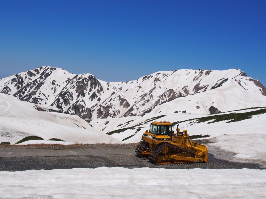
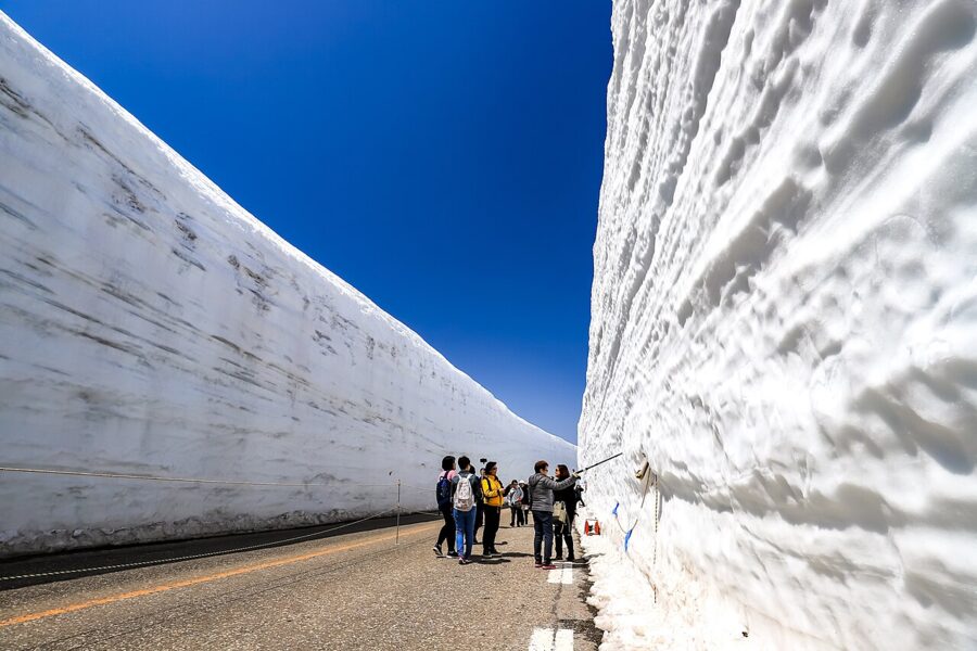

Notice the dates: in 2026 the snow wall walk ended on June 25 and the discharge began on June 26. You cannot normally get both at full strength on one trip, so choose. Snow walls mean late April to May, and I would enter from Toyama to reach the highest walls first. The discharge means summer, entering from Nagano.
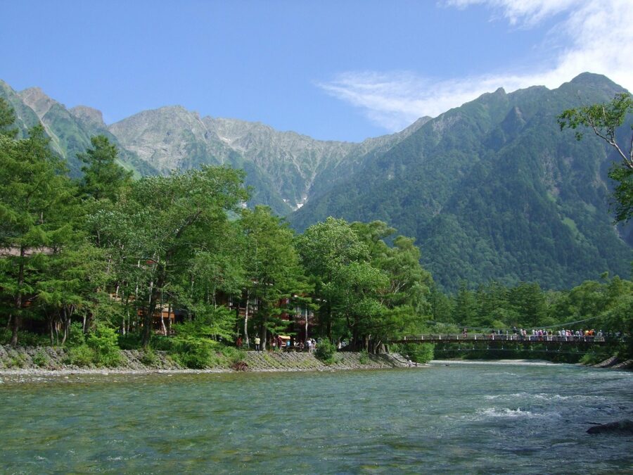
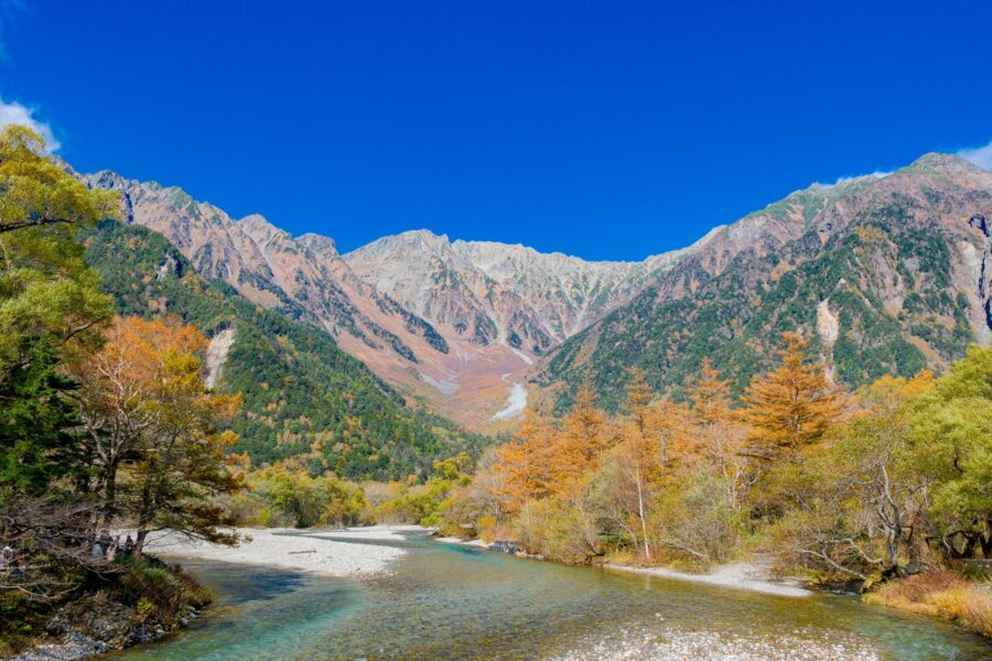
Kamikochi (上高地), the alpine valley on the other side of Matsumoto, pairs best with the Nagano approach. It is also closed to private cars, with buses from Shin-Shimashima at the end of the Alpico Kamikochi Line from Matsumoto, and its season runs from mid-April to mid-November. A route that works: Kamikochi one day, a night in Matsumoto or Ōmachi, Kurobe Dam the next.
Whichever way you come, check the discharge dates before you check the trains. Ten tons a second only falls for 112 days a year.