
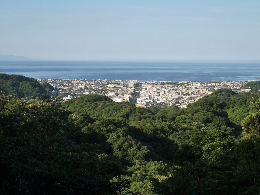

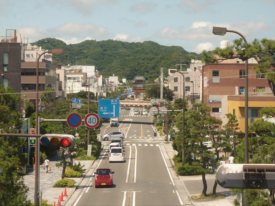
From the top of Juo-iwa, a sandstone outcrop carved with the judges of the underworld, Wakamiya-oji runs in one straight line from Tsurugaoka Hachimangu down to the sea. You get there on foot from a Zen temple, through a forest, with no road in sight. That ridge, and the path along it, is what people in Kamakura call the Kamakura Alps.
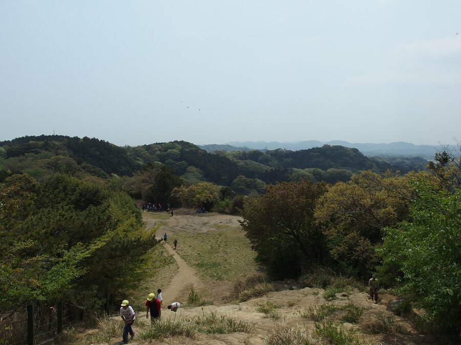
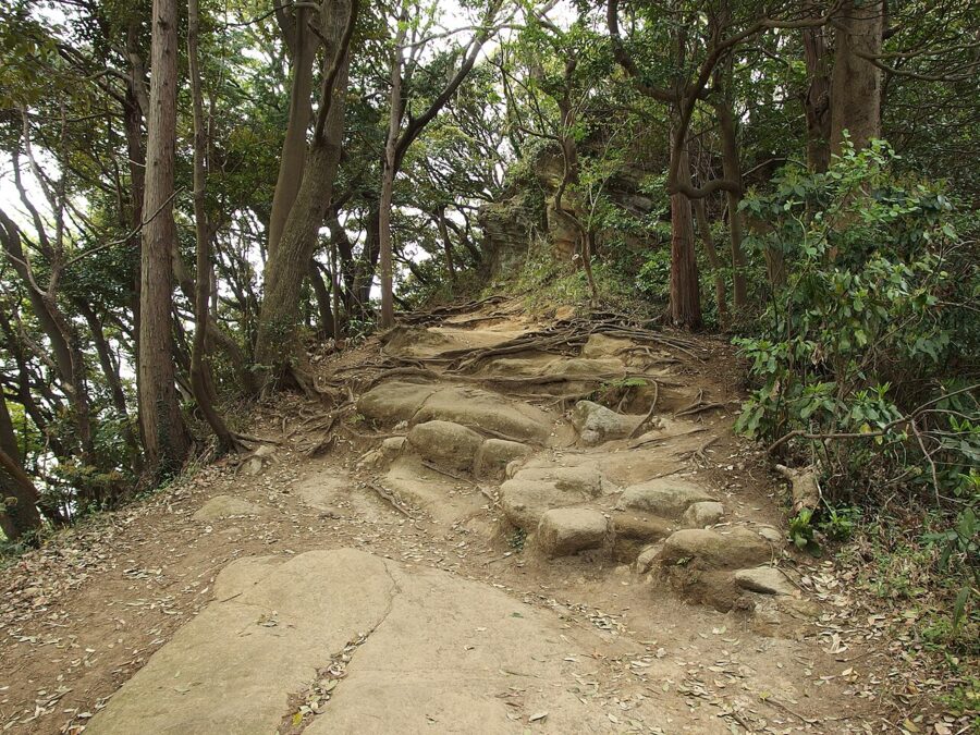
The name is a joke at the hills’ expense. The highest point is 159 meters, the walk takes about two and a half hours, and you finish at a temple garden with a bus stop down the lane. It is still a real trail, with bare rock, tree roots, a few steep steps and the odd rope, and it is the best half day you can spend in Kamakura if you want to see the city the way its medieval founders did: from above, behind a wall of hills.
It is also an easy day from Tokyo. The train to the start takes under an hour, the walk ends a short bus ride from Kamakura Station, and you can be eating whitebait on rice by mid-afternoon.


Contents12 sections
- What the Kamakura Alps are
- The route at a glance
- Kenchoji, Hansobo and the stairs up
- Along the ridge: Juo-iwa to Ohirayama
- Tenen and the ways down
- Zuisenji, the finish
- Trail status: what the city has closed and reopened
- Getting there from Tokyo, and back
- Kamakura's other hiking courses, and how to join them into a day
- Season, footwear, water, toilets and crowds
- Food in Kamakura after the hike
- Questions people ask
What the Kamakura Alps are
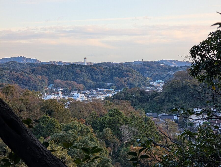
“Kamakura Alps” (鎌倉アルプス) is a nickname, not a name on any signpost. On the city’s maps the trail is the Tenen Hiking Course (天園ハイキングコース), about 5.5 kilometers by the count of the Kamakura City Tourist Association, along the line of hills that closes off Kamakura to the north and east. The hills belong to the Miura hill range, and their highest point, Ohirayama, is also the highest point in the city.
The ridge also marks the border with Yokohama’s Sakae ward, and the area around the summit, called Tenen, is where Kamakura’s paths meet the longer trails heading east into Yokohama’s hills. Ohirayama is usually given as 159.4 meters; the tourist association’s map says 159.2.
The city lists three hiking courses: Tenen, Kuzuharaoka-Daibutsu and Gionyama. “Kamakura Alps” almost always means Tenen, sometimes with the approach over Rokkokukenzan.
The route at a glance
The classic direction starts at Kita-Kamakura Station, climbs through the back of Kenchoji, follows the ridge east past Juo-iwa and Ohirayama, and comes down at Zuisenji in the Nikaido valley. From there it is a short walk to Kamakura-gu and a bus to Kamakura Station. The walking times below are the tourist association’s, not counting stops.
| Section | Walking time | What’s there |
|---|---|---|
| Kita-Kamakura Station to Kenchoji | 15 min | Road walk; temple admission ¥500 (about $3) |
| Kenchoji to Hansobo entrance | 20 min | Through the temple grounds, then stone stairs |
| Hansobo to Shojoken viewpoint | 10 min | More stairs; deck with views to the sea and Fuji |
| Shojoken to Juo-iwa | 5 min | Carved rock, the view down Wakamiya-oji |
| Juo-iwa to Ohirayama | 25 min | Ridge path; side trails to Hyakuhachi Yagura and Imaizumidai |
| Ohirayama to Tenen | 15 min | Summit area, golf course fence, rest area |
| Tenen to Kaibuki Jizo | 15 min | Over Tendaiyama (141 m), heading south |
| Kaibuki Jizo to Zuisenji entrance | 20 min | Descent into the Nikaido valley |
| Zuisenji to Kamakura-gu | 15 min | Lane walk; buses to Kamakura Station take about 15 min |
Add it up and you have about two hours and twenty minutes of walking, station to shrine. With Kenchoji, Zuisenji, a lunch stop and photos, I’d allow four to five hours and start before 10 am, which leaves the afternoon for food in town.
Kenchoji, Hansobo and the stairs up
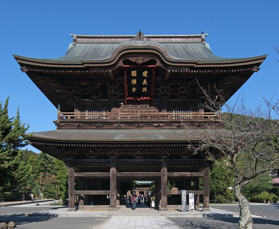
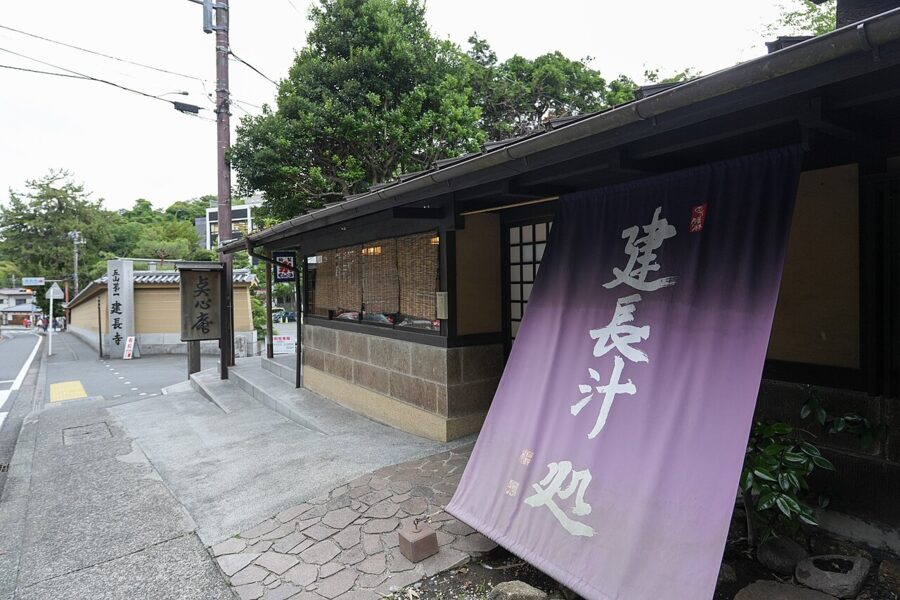
Kenchoji (建長寺) is the first of Kamakura’s five great Zen temples, founded in 1253 under the regent Hojo Tokiyori with the Chinese monk Lanxi Daolong as its first abbot. It is a fifteen-minute walk from Kita-Kamakura Station, and the trail starts behind it, so you walk through the grounds whether or not you came for the temple. Kenchoji asks hikers to pay the same admission as everyone else: ¥500 for adults and ¥200 (about $1) for elementary and junior high pupils, cash only, with the gates open 8:30 am to 4:30 pm (as of November 2026).

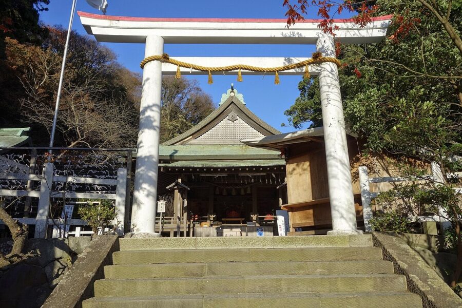
Behind the abbot’s quarters a path leads up the valley to Hansobo (半僧坊), the shrine of Kenchoji’s guardian deity. The deity was brought here in 1890 from Hoko-ji, a temple in Okuyama in present-day Hamamatsu, and is credited with protection from fire. Statues of tengu, the long-nosed and beaked mountain spirits, stand on the rocks either side of the stairs, which makes the last climb feel less like a temple approach and more like an ambush.
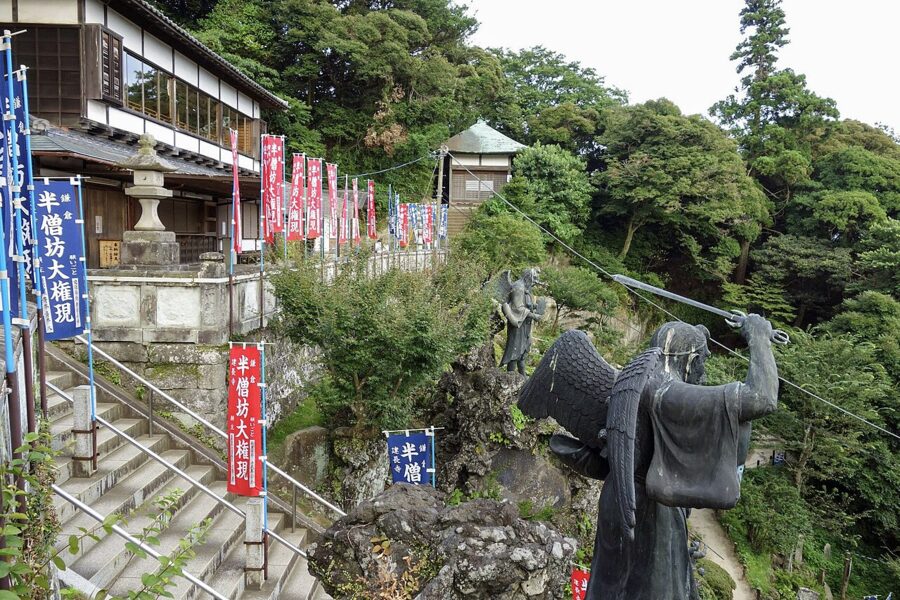

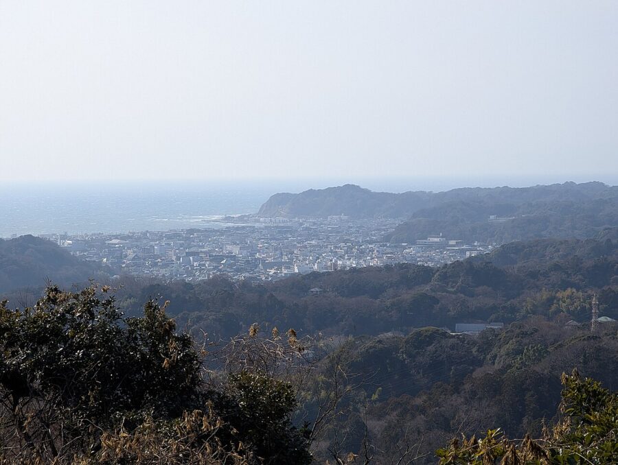
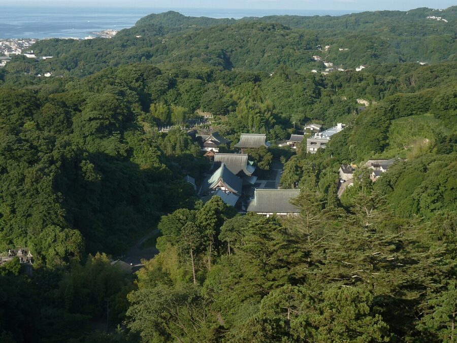
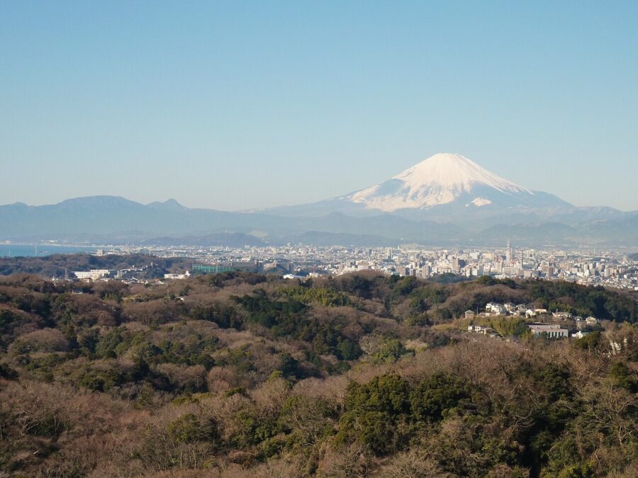
Hansobo sells its own goshuin (temple seal stamps) for ¥500 each, at a desk separate from the one in the main temple. Past the shrine, a final set of stairs brings you to Shojoken (勝上献), a wooden viewing deck on the shoulder of the hill. From here you look straight down onto Kenchoji’s roofs, and on a clear winter morning past them to Sagami Bay and Mount Fuji.


Along the ridge: Juo-iwa to Ohirayama
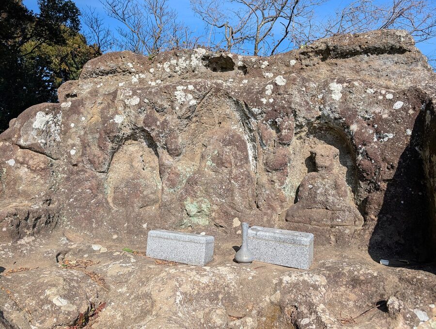
Five minutes past Shojoken the path tops out at Juo-iwa (十王岩), the “rock of the Ten Kings.” Three figures are carved into its face, now badly worn: from the left, Nyoirin Kannon, Ketsubon Jizo and Enma, the king who judges the dead. An 1829 gazetteer of Kamakura already listed a “wailing Ten Kings” cave, and local legend says the rock moaned at night. Climb onto the flat top for the view straight down Wakamiya-oji to the sea.
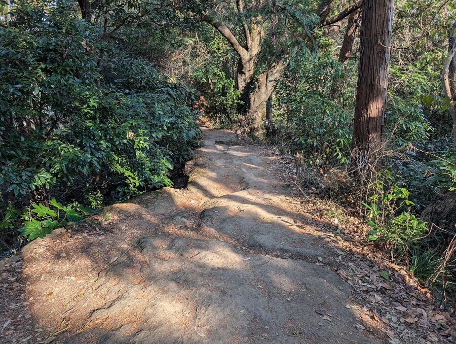
After Juo-iwa the trail settles into its character: a narrow path along the crest, sometimes on bare sandstone worn into steps and gutters, sometimes on a carpet of roots. There are short scrambles where you’ll use your hands, and one or two places with a fixed rope for the descent. None of it is exposed, but all of it is slippery after rain, and the clay sections stay muddy for days.
About halfway to Ohirayama a junction offers two short detours. Two minutes to the north is the Imaizumidai 6-chome park entrance, the back door to the ridge from the Ofuna side. Two minutes to the south is Hyakuhachi Yagura (百八やぐら), the largest group of yagura in Kamakura.
Yagura are cave tombs cut into the soft hillsides between the mid-thirteenth and the fifteenth centuries, when the city was too crowded for burials on the flat. Many held cremated remains, stone stupas and carved Buddhas, and some were plastered white inside. The Hyakuhachi group sits on the hill behind Kakuonji, founded by monks of the Risshu school, who are thought to have organized much of this kind of stonework. The name means “one hundred and eight,” a sacred Buddhist number; the real count is higher.
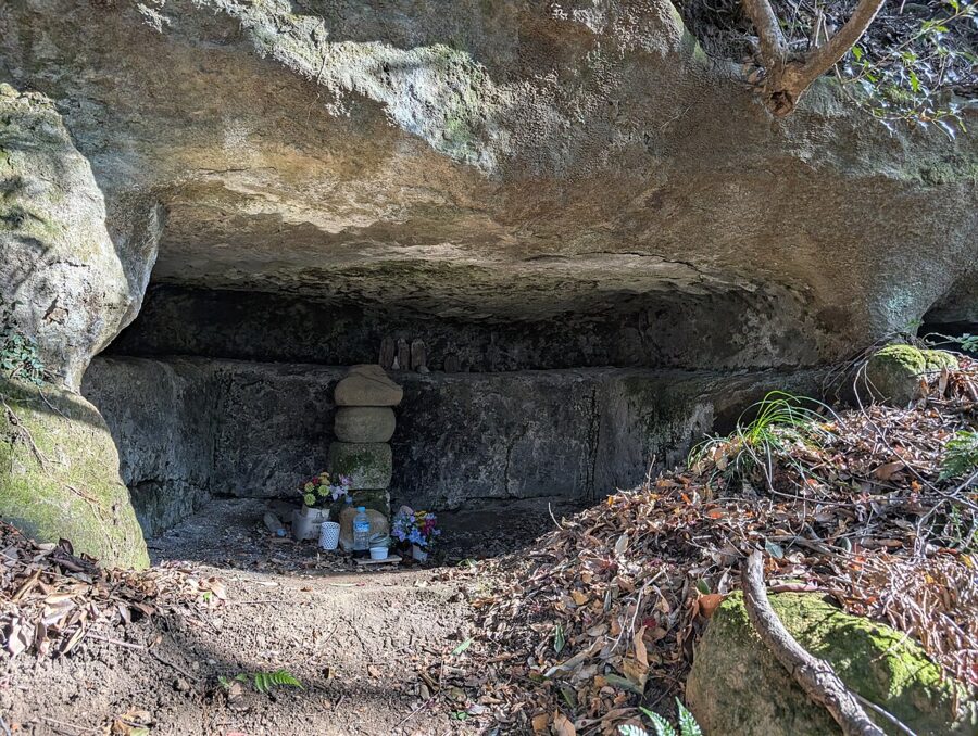
The path through the yagura is narrow and steep in places, and the cliff faces are fragile. If you want to see them, go down, look, and come back the same way to the ridge rather than improvising a route. From the junction you can also continue down past the yagura to the Kakuonji entrance, a quick way off the ridge.
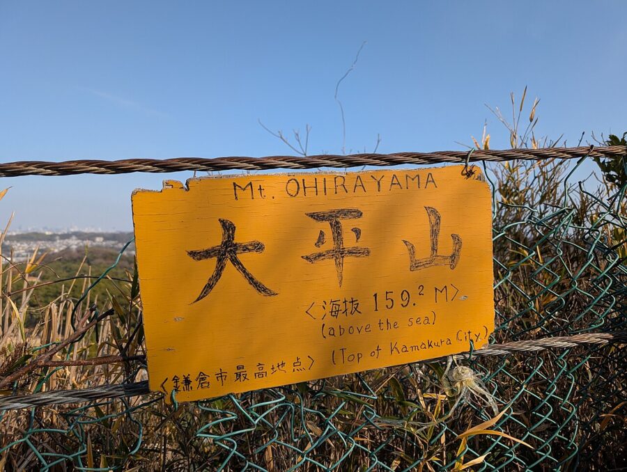
Back on the main trail, the last stretch to Ohirayama passes under tall trees and then, rather suddenly, along the fence of a golf course. The summit sign is on that fence. Ohirayama is a broad, flat top, more clearing than peak, and the views from it are partly blocked by growth, but it is the obvious place for lunch.
Tenen and the ways down
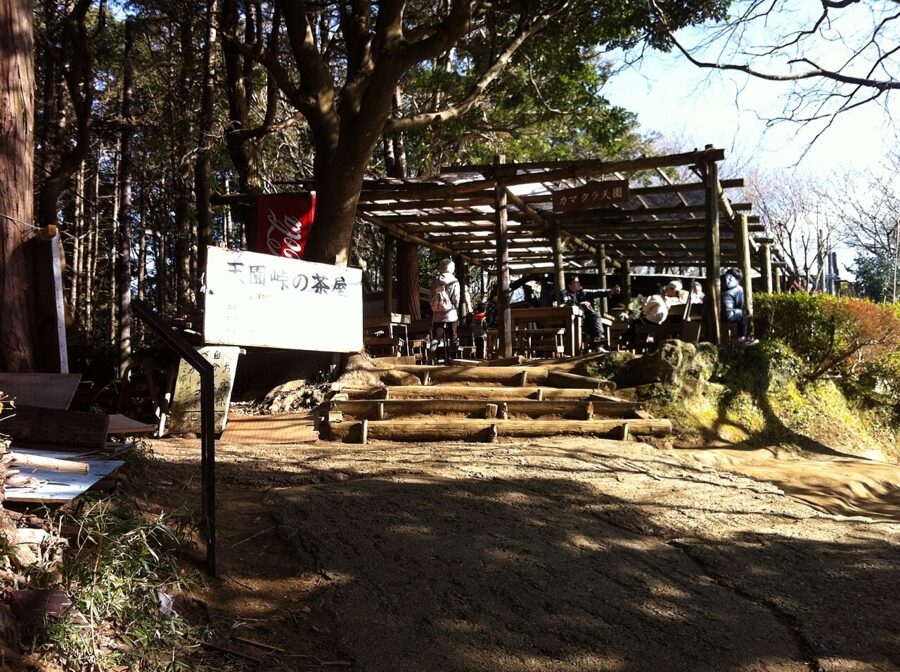
A few minutes beyond Ohirayama is Tenen (天園), the pass where the trails from Kamakura and Yokohama meet. For decades a teahouse at the pass served hikers; it closed in 2016. A rest area remains, and the tourist association’s map marks a toilet near Tenen, but there is nowhere on the ridge you can count on for food or water.

From Tenen several paths fan out, and the signposts are good. The main course turns south over Tendaiyama, a 141-meter knoll, and then down a long ridge to Zuisenji. A second path drops through the Shishimai valley to the Nikaido district near Kamakura-gu. Others continue east into Yokohama’s hill parks, which is a much longer walk and needs a separate map.
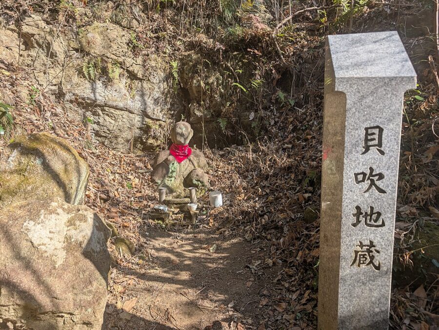
On the way down to Zuisenji you pass Kaibuki Jizo (貝吹地蔵), a small stone Jizo with a stone marker beside it. The name means “conch-blowing Jizo,” from a legend set in 1333, when the Kamakura shogunate fell and the Hojo regents died in the city below.
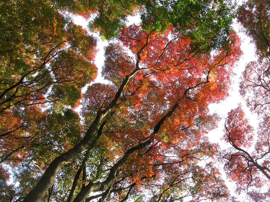
The Shishimai valley (獅子舞) is the alternative descent, and in autumn it is the one people come for. Its slopes are covered in maples and ginkgo, which in Kamakura turn late, usually from late November into early December. The path is a stream bed in places, rocky and often wet, so it is slower than the Zuisenji route and not one for smooth-soled shoes.
If you need to leave the ridge early, the Kakuonji exit (覚園寺口) comes down through the Hyakuhachi Yagura junction to the lane outside Kakuonji, ten minutes’ walk from Kamakura-gu. Kakuonji itself is a Shingon temple founded in 1296, set at the head of its own valley, and it keeps more of the feel of old Kamakura than most.
Zuisenji, the finish
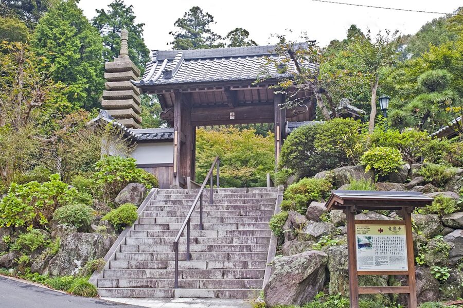
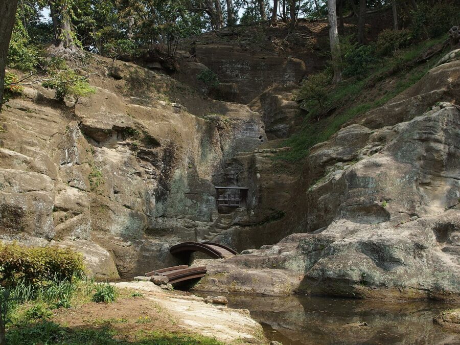
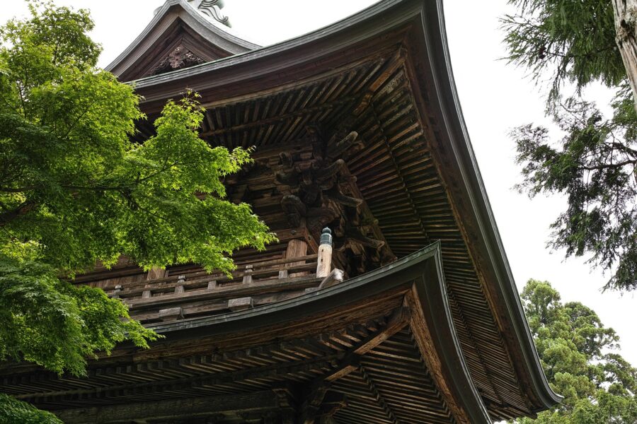
The trail ends at the top of Zuisenji’s approach, and the temple is the right reward. Zuisenji (瑞泉寺) was founded in 1327, with the Zen master Muso Soseki as its first abbot; he was also the most celebrated garden maker of his age. Behind the main hall is his garden, cut directly into the sandstone cliff, with a cave and a pond, and on the hill above it a viewing pavilion where Zen poets once met. It is a nationally designated Place of Scenic Beauty and the only garden in Kamakura surviving from that period.

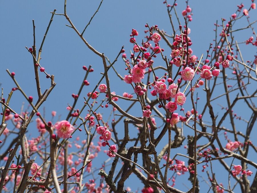
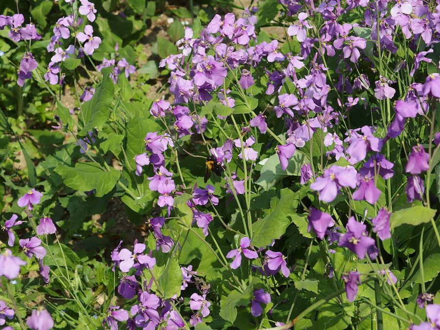
Admission is ¥200 for adults and ¥100 (under $1) for elementary and junior high pupils. The temple is open every day of the year from 9:00 am, and the gate closes at 4:30 pm (as of November 2026). Zuisenji is known as a temple of flowers: daffodils from early December, plum from late January, purple shokatsusai in March and April, and maples that the prefecture’s tourism office puts in early to late December.

From Zuisenji it is fifteen minutes on foot through quiet lanes to Kamakura-gu, a shrine founded in 1869 for Prince Morinaga, a son of Emperor Go-Daigo who was imprisoned and killed nearby in 1335. The bus stop outside is called Daitonomiya (大塔宮), after the shrine’s local name. Keikyu bus route Kama 20 runs from there to the East Exit of Kamakura Station, about every 20 to 25 minutes through the day on the November 2026 timetable, and the ride takes about fifteen minutes.

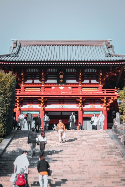
Or walk back via Tsurugaoka Hachimangu, which puts you at the top of Wakamiya-oji, the avenue you looked down on from Juo-iwa.
Trail status: what the city has closed and reopened
Kamakura’s courses run over soft rock under tall trees, and storms knock them out. After Typhoons Faxai and Hagibis in 2019, all three of the city’s courses closed for fallen trees and landslides. Gionyama was the last to reopen, on April 1, 2023.
The most recent closure was short. On March 3, 2026, a fallen tree blocked the Tenen course between the Kakuonji entrance and the Ryokuentai entrance, and the city closed that section. The trees were cleared and the city reopened it at 4 pm on March 10, 2026. The city’s announcements from then to November 2026 list no other closures on the hiking courses.
That will change with the next big storm, so check before you go. The city posts closures and reopenings as press releases on its official website, and the Kamakura City Tourist Association lists the courses with current notes on its official website. After a typhoon or heavy snow, assume some sections are closed until the city says otherwise, and follow any tape or signs on the ground. The association also notes rockfall near the Toshoji site on the Gionyama course.
Getting there from Tokyo, and back
The start is Kita-Kamakura Station (北鎌倉駅) on the JR Yokosuka Line. Trains run direct from Tokyo Station in about 52 minutes for ¥910 (about $6), or ¥902 (about $6) with an IC card such as Suica or Pasmo. From Shinjuku, the Shonan-Shinjuku Line runs to Kita-Kamakura in about an hour for ¥1,040 (about $7); some trains need a change at Ofuna or Totsuka, so check the destination board. Fares are as of November 2026, after JR East’s fare revision of March 14, 2026.
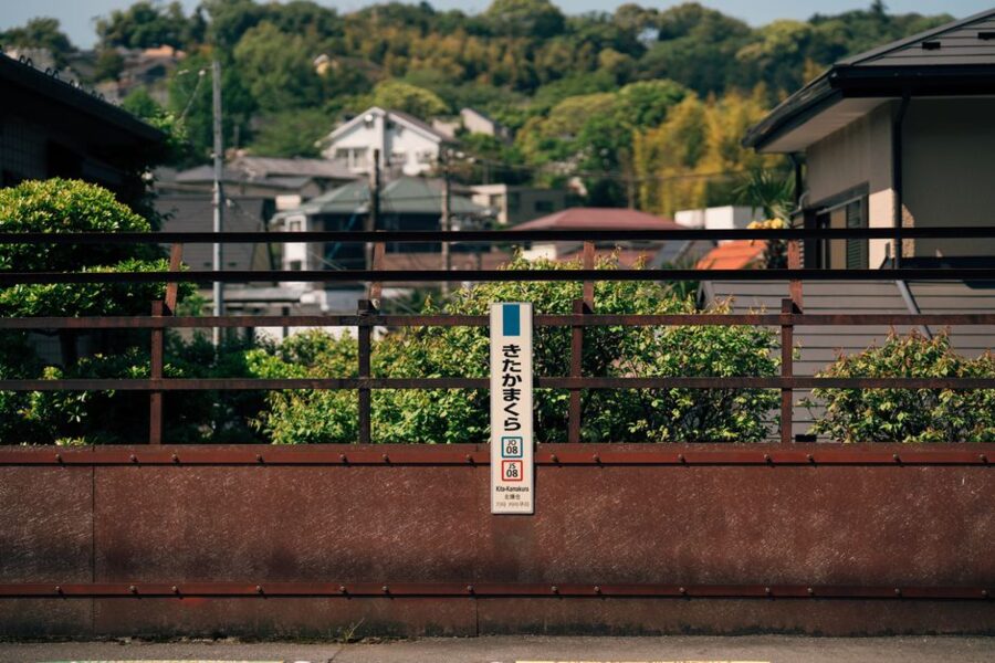
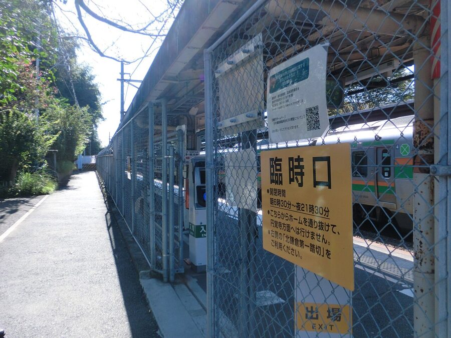
The station has a temporary entrance with a fenced passage, opened after the nearby Kita-Kamakura Tunnel was closed because of falling-rock risk. To reach Kenchoji, follow the Kamakura-kaido road south past Engakuji, Tokeiji and Jochiji; the temple’s own directions put it at about fifteen minutes on foot, or five minutes by the Enoden bus toward Kamakura Station.

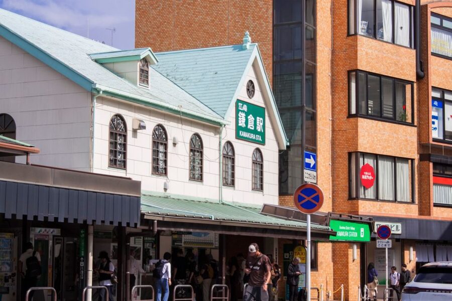
The way home is from Kamakura Station, on the same JR lines. Kamakura to Tokyo is about 55 minutes direct on the Yokosuka Line for ¥1,040 (¥1,034, about $7, by IC card); Kamakura to Shinjuku is about an hour on the Shonan-Shinjuku Line, also ¥1,040. The Japan Rail Pass covers both lines. The Keikyu buses from Kamakura-gu accept IC cards.
Other places to start
You don’t have to start at Kenchoji. From Kita-Kamakura you can walk about twenty minutes through the Imaizumidai housing estate to the Imaizumidai residential entrance, which joins the trail at Hansobo without walking through the temple. From Ofuna Station, Enoden buses toward Kamakura-ko take about fifteen minutes to the Hansobo-shita stop, five minutes from the Imaizumidai 6-chome park entrance in the middle of the ridge.
You can also walk it in reverse, from Zuisenji up to Tenen and down through Kenchoji. Just be through Kenchoji before its gates close at 4:30 pm.
Which way I’d walk it
North to south, from Kenchoji. The stairs come while your legs are fresh, Shojoken and Juo-iwa get the morning views, and you finish near food and buses. Reverse it only to link the Daibutsu course, as in plan two below.
Kamakura’s other hiking courses, and how to join them into a day
Three other courses are worth knowing, and two of them link neatly with Tenen.
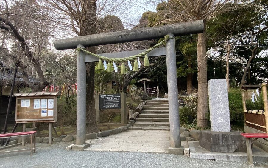
Kuzuharaoka-Daibutsu Hiking Course (葛原岡・大仏ハイキングコース). About 3 kilometers and an hour and a half, rated for beginners by the tourist association. It starts beside Jochiji near Kita-Kamakura Station and runs over the western hills to Kuzuharaoka Shrine, Genjiyama Park with its statue of Minamoto no Yoritomo, and down to the Great Buddha at Kotoku-in, finishing at Hase Station on the Enoden line. Short detours lead to Zeniarai Benten and Sasuke Inari shrines.

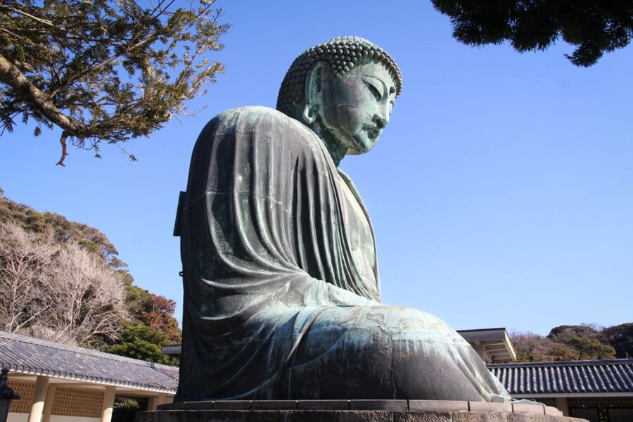
The Great Buddha at the end of that course is at Kotoku-in (高徳院). The gates open at 8 am and close at 5:30 pm from April to September and at 5 pm from October to March, with entry until fifteen minutes before closing. Admission is ¥300 (about $2), and for another ¥50 (well under $1) you can step inside the statue until 4:30 pm. Eating and drinking are banned throughout the temple grounds.
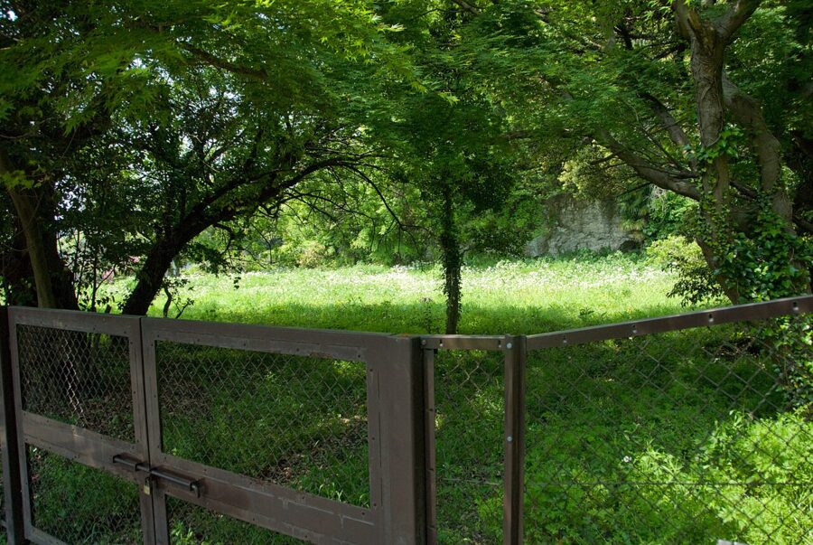
Gionyama Hiking Course (祇園山ハイキングコース). The shortest of the city’s three courses, close to Kamakura Station, over a low hill above the site of Toshoji. That temple was where the last Hojo regent and his followers took their own lives in 1333, and a yagura near the site is known as the Harakiri Yagura. This course reopened on April 1, 2023 after storm damage; it is short but steep in places.
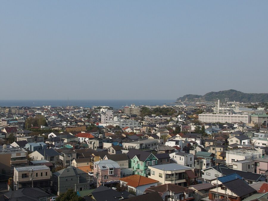

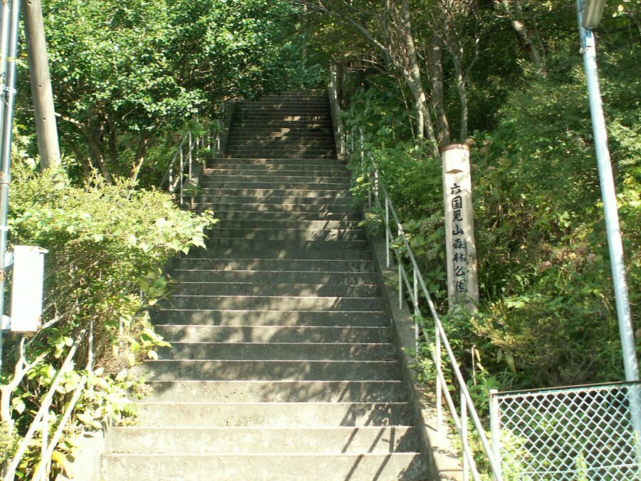
Rokkokukenzan (六国見山). A 147-meter hill above Kita-Kamakura, often walked as the northern start of the Kamakura Alps, with an observation deck and an 1895 stone monument to the goddess of Mount Fuji. The name means “hill from which six provinces can be seen.” From Kita-Kamakura it’s twenty minutes to the Meigetsu-dani entrance, then twenty more to the deck.

Plan one: Rokkokukenzan plus Tenen
Start at Kita-Kamakura, climb Rokkokukenzan via Meigetsu-dani, then walk down through Imaizumidai and join the Tenen course at the Imaizumidai entrance. Follow the ridge to Tenen and down to Zuisenji. This skips Kenchoji but adds a quieter hill and a second viewpoint; allow five to six hours with stops.
Plan two: Tenen in reverse, then the Daibutsu course
This is the long version, and the one reason to walk Tenen backward. Take a bus from Kamakura Station to Daitonomiya, walk to Zuisenji, climb to Tenen and follow the ridge west to Shojoken and down through Kenchoji before 4:30 pm. Walk north along the main road to Jochiji, pick up the Daibutsu course and finish at the Great Buddha. That’s about four hours of walking plus stops, so start by 9 am in winter.
If you’d rather spend the second half of the day in a city, Yokohama Station is on the same Yokosuka Line, and the Western houses on the Yamate bluff make a good counterpoint to a morning in medieval Kamakura.
Season, footwear, water, toilets and crowds
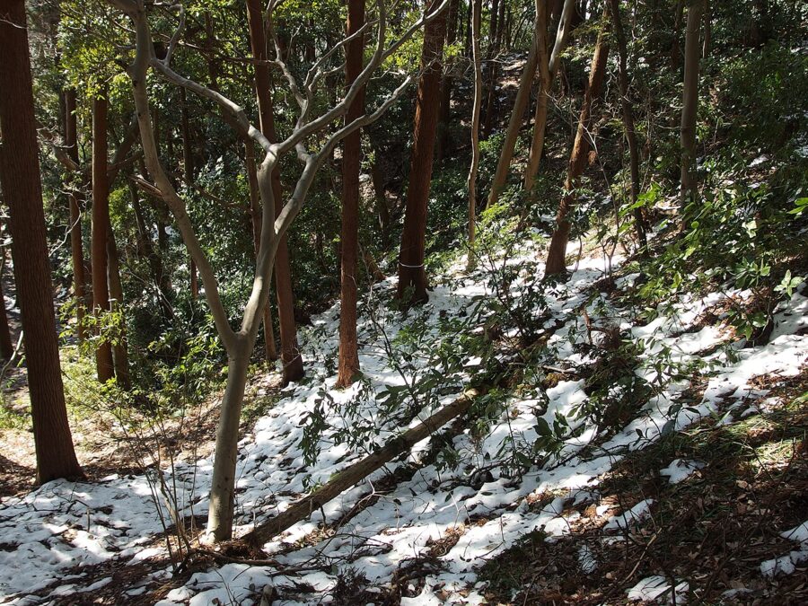
The trail is open all year, but it changes a lot with the season. Winter, from late November to February, is the best time for views: the air is dry, the leaves are down, and Fuji shows from Shojoken and Juo-iwa on most clear mornings. Snow is rare, but when it falls the rock steps ice over in the shade.

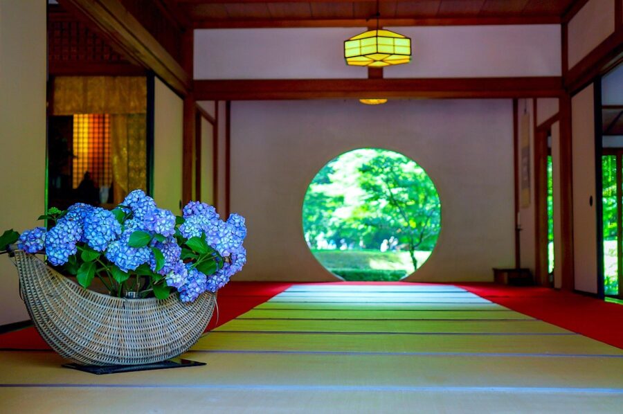
Spring brings plum blossom at Zuisenji from late January and shokatsusai into April. June is hydrangea season at Meigetsuin in Kita-Kamakura, which crowds the station but not the ridge. Summer is hot and humid even at 150 meters, and the tourist association warns that hornets are active from summer into autumn; don’t wave at them, and give any nest a wide berth.


Footwear. Trail shoes or light hiking boots. The tourist association warns that the courses are natural mountain paths with slippery sections and steep climbs, and after rain the clay becomes very slick. You can walk it in sturdy sneakers with a good tread in dry weather, but I wouldn’t in city flats or anything with a smooth sole.
Water and food. Bring all of it: there is nowhere you can rely on to buy either between Kenchoji and Zuisenji. A liter of water each does in winter; take more in summer.
Toilets. Use the ones at Kenchoji before you climb. The tourist association’s map marks toilets near Tenen, at Kakuonji and at Zuisenji, and none on the ridge before Tenen.
Crowds. Weekend mornings in November and December are the busiest, along with Golden Week in early May. Trail runners use the ridge too; the city asks them to slow down and give way, and asks organizers not to hold races. On a weekday in January you can have long stretches to yourself.
Rules. No bicycles or motorbikes, no fires, and carry out your trash. Near the trailheads the path runs close to houses, so keep your voice down.
Food in Kamakura after the hike
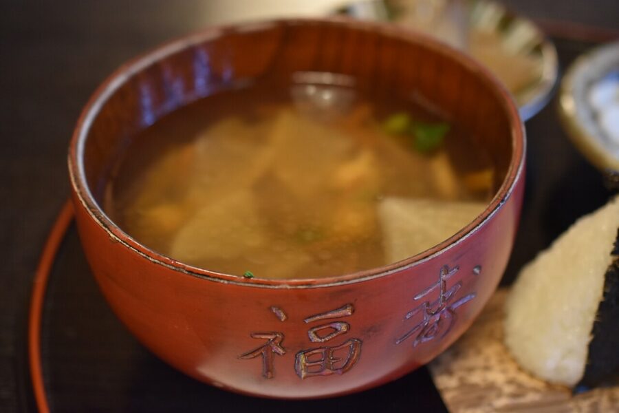
The best dish for this hike is waiting at the start. Kenchin-jiru (けんちん汁) is a clear soup of root vegetables, tofu and konnyaku fried in sesame oil, simmered in kombu and shiitake stock, with no meat or fish. Local tradition says Kenchoji’s monks invented it as “Kenchō-jiru,” though dictionaries trace the name to a Chinese-style dish called kenchin. In 2025 the Agency for Cultural Affairs named Kamakura’s Kenchō-jiru one of its “100-year foods.”


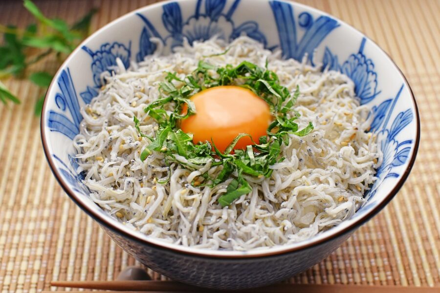
At the other end of the walk, Kamakura’s own dish is shirasu, tiny whitebait from the local coast, served on rice as shirasu-don, boiled or, when the catch allows, raw. Raw shirasu depends on that morning’s boats, so ask before you order.
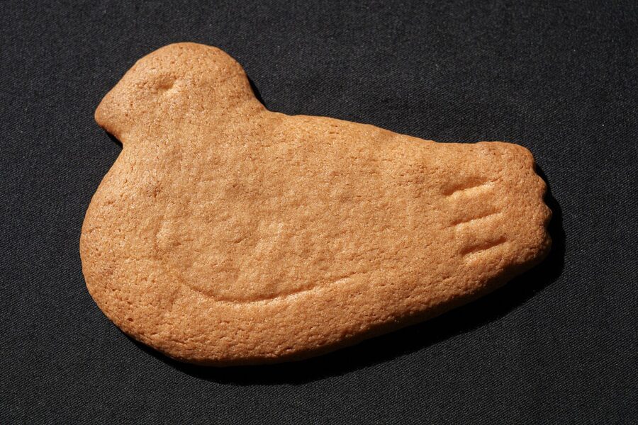
For something to take home, Toshimaya’s Hato Sablé, a pigeon-shaped butter biscuit, has been Kamakura’s standard souvenir for generations. The main shop is on Wakamiya-oji, open 9 am to 7 pm, closed on some Wednesdays (open on holidays). There is also a branch by Kita-Kamakura Station, open 10 am to 5:30 pm and closed on Wednesdays, if you want to buy them before you start.

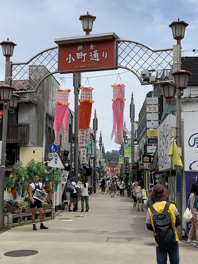
Komachi-dori, the street from the station to Tsurugaoka Hachimangu, is lined with snack stands and sweet shops and packed on weekends. Wakamiya-oji, one block over, is calmer.

Questions people ask
How long does the Kamakura Alps hike take?
About an hour and a half on the ridge itself, Hansobo to Zuisenji, and two hours twenty minutes station to shrine. Allow four to five hours with temples and lunch.
How hard is it? Can children do it?
The courses are pitched at beginners and the total climb is small. The hard parts are the Hansobo stairs, a few short scrambles and mud after rain. Children used to walking a couple of hours manage well; strollers don’t.
What is the best way to get from Tokyo to Kamakura?
The JR Yokosuka Line from Tokyo Station, direct to Kita-Kamakura in about 52 minutes. From Shinjuku, take the Shonan-Shinjuku Line, about an hour.
How many hours do I need in Kamakura?
A full day for the hike, the two temples and lunch. Add the Great Buddha only if you follow plan two, or come back another day.
Is the trail open now?
As of November 2026, yes. The one closure in the past year, near the Kakuonji entrance in March 2026, lasted a week. Check again after any typhoon.
Start early, and on a winter morning go straight up the Hansobo stairs before you look at anything else. By eleven the haze is in, and the line from Juo-iwa down Wakamiya-oji to the sea is the reason you climbed.